RETURN TO PREVIOUS INDEX
Denali 1986
In 1986, Dave Wunker, Bob Mutel, and I (Craig Walker) climbed the
West Buttress route on Denali, the highest mountain in North America
(formerly known as Mt. McKinley). We flew from Talkeetna, AK with
Doug Geeting Aviation to the Southeast Fork of the Kahiltna Glacier,
the starting point for the route. The West Buttress is the route used by most
Denali climbers. We were on the mountain from June 4 to 20.
Dave and Bob flew to Alaska for the climb. My wife, Joan, and I
drove to Alaska - a vacation in its own right. We met the others at
the Anchorage airport at which time Joan flew south to spend time with
collaborators in California. After the climb, Dave, Bob, and I made a
quick visit to the north side of Denali National Park before returning
to Anchorage to put Dave and Bob on planes south and pick up Joan, who
returned for the drive home. Before heading south, she and I went
back to Denali National Park where we had the good fortune to camp at
Wonder Lake. See the last photo for a wonderful experience we had
there. We then drove home to New Mexico, stopping to visit Joan's
family, hike in the mountains near Lake Louise, and visit my sister,
all in Alberta, on the way. The drives will be the subject of another
photo set. It's a long drive - I was away from home from May 21 to
July 15.
The climb of the Denali West Buttress was not technically
difficult, although one needs to be careful about crevasses, many of
which have snow bridges that show no evidence on top. There is also
some fairly steep snow along the Buttress and above. The main issues
relate to the weather and physiological effects of the altitude and
near arctic location. There were several other parties on the
mountain. It was a bit weird doing a big mountain expedition in a
remote location in a crowd. Just over 1000 people a year try to climb
the mountain, most on the West Buttress route, and mostly during a 2
month period between the cold weather and the snow melt giving too
many exposed crevasses. Each group spends 2 to 3 weeks on the
mountain. Hence the crowds. About half make the top.
In the end, I was one of those who did not make the summit but Bob
and Dave did. I had lost my final conditioning efforts during the
drive up during which I was fighting off a bug of some sort. I wasn't
completely free of it on the mountain. Plus I am somewhat susceptible
to altitude. We went from the 14000 ft camp to the 17000 ft camp one
day, then had good weather the following day and started for the
summit. It quickly became apparent that I needed at least another day
of acclimatization so I returned to the camp. The other two went on
to the top. The following days did not have acceptable weather and we
needed to get back for Bob and Dave to catch their flights so I missed
the top.
I have annotated the photos based on my log book, maps, Google
Earth, and my fading 37 year old memories. I might not have
properly identified all the locations, but should be close.
The photos were taken with my Konica Autoreflex T3 using Kodachrome
25 or 64, I don't remember which. I don't think I was using Velvia by
then. I digitized the photos in October 2023 using my Pentax K5 and
100mm macro lens along with the slide holder from an old film slide
duplicating mount, all mounted on a piece of slotted angle iron that I
happened to have lying around. I did invest in a traveling stage to
go between the angle and the camera to help with framing. The
digitized photos were processed in Raw Therapee and the Gimp. White
balance can be a rather tricky issue with snow so processing took some
effort. I am rather happier with the results from that setup than I
was with the very labor intensive slide scanner that I used for a
while years ago. The slides were 37 years old when scanned and showed
no signs of aging. I have other slides at least 60 years old that are
also still in good condition. Kodachrome was a very good film. The
photos from Dave and Bob that are included were scanned from duplicate
slides made in 1986. That duplication process results in some loss of
quality. Note that any EXIF data with the photos, including what is
shown below the photos, is from the scanning process, not the original
photography.
Click on the image for a screen size version.
The "2000" and "full size" versions are larger (not available in web versions).
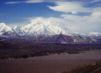
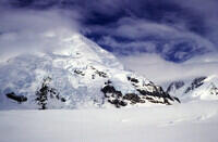
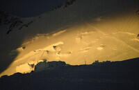
View of Denali from the Eielson Visitor Center north of the mountain. The
visitor center is at about 3700 ft elevation and the river at about 3100 ft.
The summit is 20320 ft so there is a lot of relief. Talkeetna, on the
south side, also with a good view of the mountain, is at 350 ft.
|
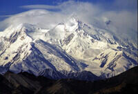
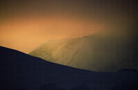
Telephoto view of the north side of Denali from the Eielson Visitor Center.
|
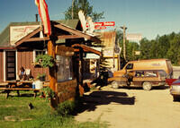
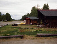
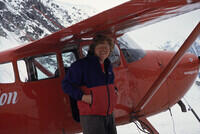
Downtown Talkeetna and the office of Doug Geeting Aviation. The brown Colt
wagon was ours. It passed 100,000 miles on this trip.
|
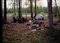
Camping before the climb. Eagle River Campground near Ancohorage, I think.
|
One of the streets in Talkeetna served as an airstrip. There was also
a real airport.
|
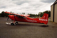
Geeting's ski plane at the airport. He had a sticker on his yoke that read
"If in doubt, don't"
|
Looking back on Talkeetna on our first attempt to fly in.
|
Heavy fog. We were not able to get to the Kahiltna glacier on this flight
|
Returning to Talkeetna - lining up on the street/runway.
|
Next day, next try - much better.
|
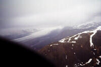
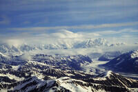
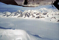
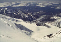
Some of the mountains on the flight to the Kahiltna.
|
The Kahiltna glacier from the flight in.
|

Lining up on the "landing strip" on the Southeast Fork of the Kahiltna.
|
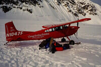
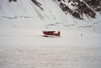
Geeting's plane on the landing area with our pile of gear.
|
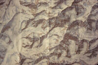
Photo of a map of Mount McKinley that we used on the mountain. See the
next image for a more modern map with the route marked.
|
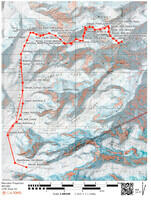
This is a modern map found at
https://caltopo.com/p/D4NEA
showing the West Buttress route. The full interactive caltopo map is
at this link. We camped at or
near places marked Denali_Camp1, Kahiltna_9800, Denali_11K_Camp (Next
dot below Motorcycle_Hill (Top)), Denali_14K_Camp, and Danali_17K_Camp.
On the way down, we used the 17K and 14K camps and sites at about 9500
ft and 7500 ft on the Kahiltna. See the web site to see more labels
that appear when you zoom in.
|
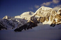
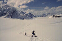
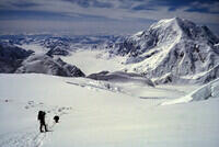
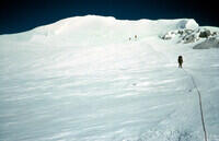
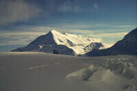
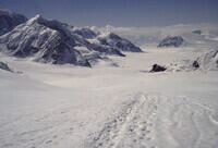
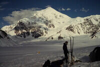
Looking toward the summit from the Kahiltna.
|
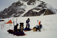
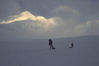
Getting ready to leave the airstrip, I think. Note the mixed skiis
and snowshoes. That's ok going up, but complicated going down when
the skiers want to slide and all are roped together. The sleds kept
the pack weights down, but could be hard to handle at times. Note
also that we are not alone. There were upwards of 50 people at some
of the camps.
|
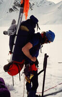
Dave loading up. The climbing hardware at his belt is to use in case of
a crevasse fall. The wands are for marking the trail in case of white out.
The aluminum stake is for protection on steep snow.
|
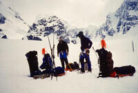
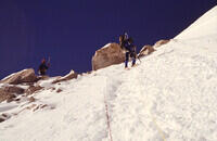
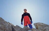
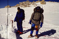
Bob (right) and I getting ready. This is a photo by Dave and was digitized
from the slide copy made just after the trip.
|
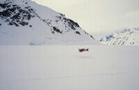
A K2 Aviation plane arriving at the airstrip. Note the airstrip is really
just a stretch of glacier without crevasses that is marked by dark objects
in the snow. Without the markers, it is nearly impossible for the pilot
to tell how high he/she is.
|
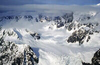
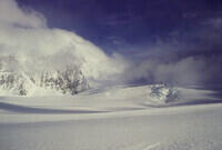
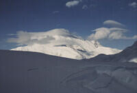
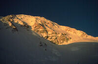
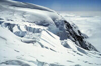
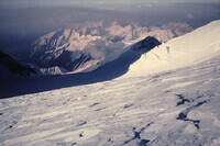
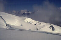
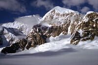
When the sun is out, there are amazing views in all directions.
|
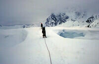
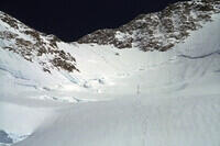
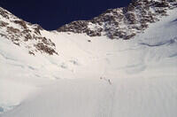
Most of the trip up the glacier was on wide, smooth snow on ice. But
occasionally there were holes! When those holes were covered with
snow, that snow didn't sag, as it does in more temperate climates, so
you really should remain roped. Many of the fatalities on Denali are
experienced climbers who think they can tell where the crevasses are
and don't rope. Some of those have been European mountain guides.
|
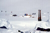
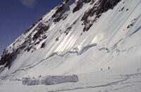
A camp on the glacier. Note the wands around the campsite. We have
probed the area inside the wands and know there are no crevasses.
At one camp, there was a notch in the perimeter because our probes
found no bottom even though there was no sign on the surface of
trouble. Note that, to take the picture, I went outside the wands - roped.
|
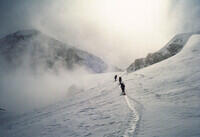
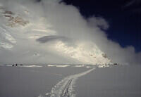
Occasionally we ran into white-out conditions. This was pre-GPS so,
without the wands or a beaten path, navigation would have been
difficult and, because of the crevasses, dangerous. With so many
people on the mountain, there usually was a path.
|
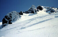
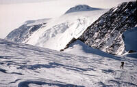
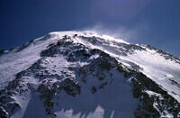
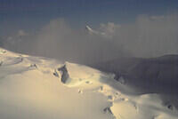
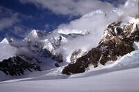
More good views in nice weather.
|
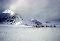
The camp of one of the larger guided groups with another in the
distance.
|
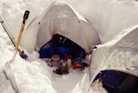
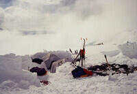
Our camp. We cooked just outside the tents, usually while sitting
inside. Cooking inside the tents is dangerous as proven tragically
while we were there. We encountered a group bringing down the bodies of
two young Swiss climbers who had asphyxiated themselves that way.
|
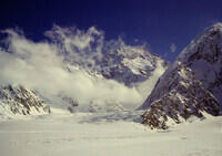
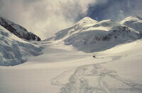
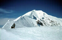
The view toward the summit of Denali from near our first camp.
|
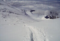
Looking back down the beaten path past one of the mid-glacier camps.
|

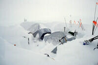
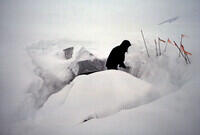
Digging in. Most people on the mountain used snow block walls to
shelter their tents in case of servere winds. As it turned out, we
did not have such weather.
|
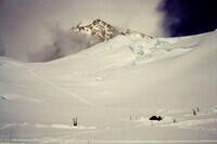
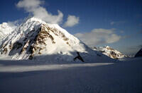
Looking up from a glacier camp.
|
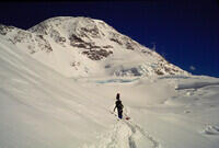
On the trail above Kahiltna Pass.
|
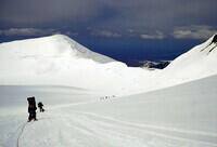
At the camp near 11000 ft. looking up.
|
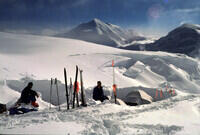
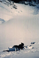
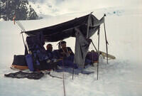
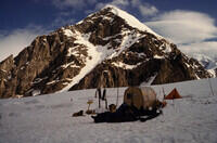
Our camp at about 11,000 ft. We attempted to save fuel by melting
snow on plastic tarps. It wasn't all that successful.
|
This is from the 11,000 ft camp seen in the previous picture. It
is overlooking Kahiltna Pass and Kahiltna Dome. You can see the
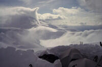
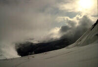
fog pouring over the pass to the glacier below.
|
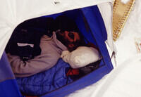
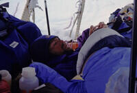
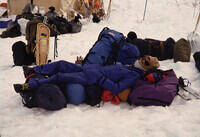
Dave sleeping.
|
The same camp in a white-out after a snow fall.
|
Other parties in the vicinity. The bundle of skiis is probably a cache
left by a party higher on the mountain.
|
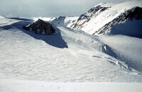
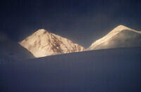
Mount Crosson with Kahiltna Dome to the right seen from the 11,000 ft
camp. Identified with Google Earth.
|
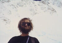
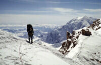
Dave.
|
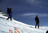
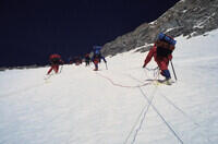
A typical view of the trail with traffic. The wide spacing between people
is because they are roped;
|
Mount Crosson seen from the 11000 ft camp. Kahiltna Pass is a bit to the
right. Identified with Google Earth ground view.
|
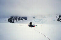
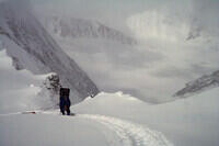
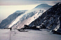
Heading toward Windy Corner where we left a cache and returned to 11000.
|
Digging out after a snow storm. This is still at the 11000 ft camp.
|
This looks to be the trail above 11000 ft near the place marked as
Motorcycle Hill on the modern map (I have no memory of that name from the
trip). We are now on our way to the major campsite at just over 14000 ft.
|
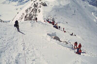
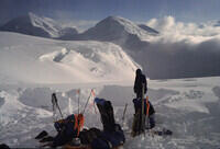
Arriving at the 14000 ft camp. There were on the order of 50 people
here, although not all the tent sites are visibie in this photo. Usually
at these camps you can use a pre-existing shelter rather than construct one
from scratch. The camp also had a communal pit toilet.
|
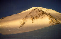
Looking toward the summit in the evening.
|
Mount Crosson again in the evening.
|
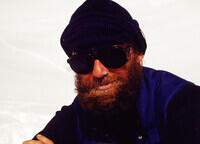
Would you trust this man with your life! Dave looking a bit ragged.
|
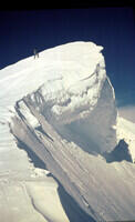
Some of the ice fall activity in the vicinity.
|
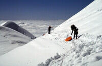
Returning for our Windy Corner cache, I suspect. Note the empty sled.
|
Approaching Windy Corner, I think.
|
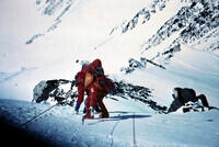
Heading back up with loads. Unless loaded with very low centers of
gravity, the sleds tended to roll.
|
At the 14000 ft camp.
|
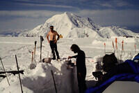
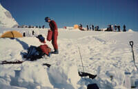
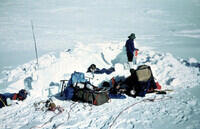
Cooking at the 14000 ft camp. There were rangers and a doctor at this
camp. It is the main collecting point along the route and is normally
well populated. After a poor night's sleep, I had my oxygen checked.
It was ok.
|
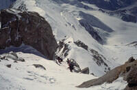
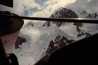
Looking up the route ahead. The path is visible heading up the
glacier and the steeper slopes to the West Buttress ridge. The route
then goes along the ridge to the 17000 ft camp. There are fixed lines
on the steeper snow slope.
|
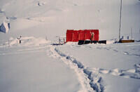
The medical tent. They do some research on the response of climbers
to altitude here where they can get a good sample.
|

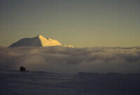
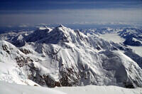
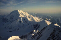
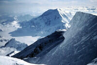
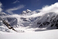
Mount Foraker from the 14000 ft camp. Mt. Crosson is in the foreground.
Foraker is the second highest in the range at about 17,400 ft.
The tents are from some other party.
|
Heading to the saddle on the North Buttress above the 14000 ft camp.
There was a traffic jam on the fixed ropes.
|
Looking down on the 14000 ft camp from the climb.
|
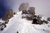
At the ridge.
|
A couple of other climbers coming down. I think these might have
been the ones who did the landing strip to summit in one push. They
had been living at the 14000 ft camp helping the operation there so they
were well acclimatized. I think they were the ones who took the Swiss
bodies to the airstrip.
|

The crowd collected at the saddle.
|
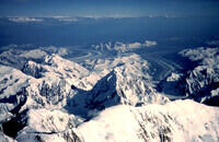
Looking to the north side of the range. Note the base elevations to
the north are about 2500 ft and to the south are under 700 ft. With
the summit at 20,320 ft, This gives Denali, some claim, the greatest
above-sea-level base to top difference in the world. Mauna Kea is
much more if you include the under-ocean base.
|
From the ridge looking toward Foraker.
|
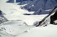
Looking down toward the Kahiltna Glacier. If you look closely, you can
see the climbing track. The two sharp peaks are Mt. Hunter and South
Hunter.
|
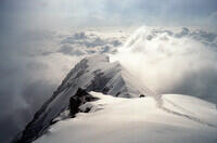
Looking south from the ridge.
|
We left a cache at the ridge and headed back down.
|
The 14000 ft camp from above. Our tents are, I think, sort of in the
middle of the main cluster. They are grey while most are orange or some
such.
|
At the 14000 ft camp.
|
Evening at 14000 ft.
|
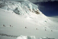
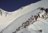
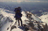
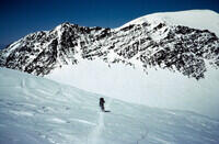
Heading up again in fine weather. A lot of other climbers are also going
up to the West Buttress.
|
On the fixed ropes (yellow) heading for the ridge.
|
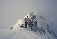
At the ridge. A lot of climbers stopping for lunch. Some camping.
|
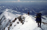
Heading up along the West Buttress.
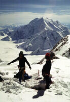
|
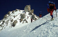
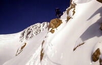
Another climber on the ridge.
|
Looking down along the ridge.
|
Getting near the top of the ridge.
|
Approaching the 17000 ft camp. The camp is before the big slope
in the background. You can see the trail above the camp cutting diagonally
up and left across that slope. That area has been the scene of a number
of accidents with people falling on hard packed snow.
|
More along the ridge, looking back.
|
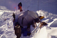
Starting to set our camp at 17000 ft.
|
The tent set up. We only use the one tent at this site. I was last in
and squeezed badly in a corner. That was one of the reasons I did not
sleep that night and had no energy the next day.
|
Looking back at Mount Foraker.
|
Dave and Bob ready to go the next morning. I went about half a mile
before realizing that I just did not have the energy to make a summit
push. So I returned to camp and they went on. It was a very nice day
but I badly needed more acclimatization. Also I don't think I had
completely shaken the bug from the drive up.
|
Heading toward the summit. The next several photos are from Dave and
Bob. They were copied on slides in 1986 and digitized with the rest
of the photos here in 2023.
|
There are three people here - count the feet. As I recall one had
a problem and needed help. None were our party.
|
After the big slope, the back side approach tothe South (high) summit
of Denali was on milder terrain. Person is Bob so photo by Dave.
|
Headed toward the summit. Person is Bob so photo by Dave.
|
Higher toward the summit. Again person is Bob so photo by Dave.
|
Approaching the summit. It looks like they dropped packs for the
last bit. I think this is Bob so photo by Dave.
|
Looking south from near the summit, I think. They were high in
the afternoon so the sun was in the west, shadows to the east.
|
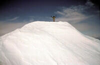
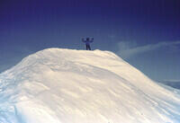
Bob on the summit. Photo by Dave.
|
Looking back where they had come from in the summit area.
|
Looking down at the Kahiltna Glacier, I think, from the summit.
|
Dave on the summit so photo by Bob.
|
Looking north. The first ascent route came from that side.
|
Headed down. Person is Bob so photo by Dave.
|
Another on the way down by Dave.
|
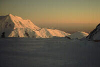
Sunset view from camp showing the trail crossing the big slope.
Note the sun barely dips below the horizon at this time of year
at the latitude of Denali. Back to my photos.
|
The same slope later.
|
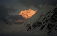
Sunset lighting.
|
The next day, there were high winds near the summit so nobody tried to
go up, including me. I think I was strong enough the following day to
go, but the weather did not cooperate that day either. Also Dave and
Bob had flights they needed to catch and I did not feel comfortable
leaving them to their own devices on the glaciers by heading up with
another party (I had offers). I was the only one of the team with
glacier experience. So I did not get to go to the top.
|
Headed down the Buttress.
|
Another along the Buttress.
|
Bob, I think, working down along the ridge. It got rather steep in places
and we did some belaying. This photo might be a bit tipped too.
|
Continuing down the ridge. The path drops off to the south in the
stretch you cannot see.
|
Back in the 14000 ft camp and starting down from there.
|
Looking south from below the 14000 ft camp.
|

Some crevasses along the way.
|
Looking south again toward Mt. Hunter, I think.
|
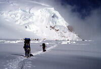
This is probably the 11000 ft camp. We had left our skiis there.
|
At the 11000 ft camp and recovering our cache. We left nothing
on the mountain.
|
From somewhere near the 11000 ft camp. We headed down to about
9800 ft the day we left 14000 ft.
|
Light fog as we descend. Eventually we put the skiis/snow shoes
back on.
|
The end of the West Buttress as seen from arount the 9800 ft camp.
The climbing route does not go out to that end of the buttress.
|
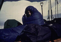
On the descent, I didn't bother sleeping in the tent. I just used
my sleeping bag in the open. This one is of me.
|
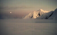
The Moon and Mt. Foraker behind Mt. Crosson.
|

Camp at 9800 ft.
|
Looking down glacier. The landing area is not on the big side
glacier (East Fork) but around the corner below that.
|
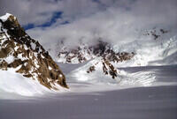
Some scenery. I duplicated the view with Google Earth ground view
and the mountain is Mt. Hunter as seen from our 7500 ft layover site.
|
This is the layover site at 7500ft. We were coming up on the
crevasse fields near the start of the Southeast Fork of the Kahiltna,
where the landing strip is located, and the snow was very soft in
the afternoon. We waited here until midnight to let it firm up.
|
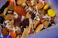
Some gorp. We had lots of it.
|
Bob in his bag at the layover.
|
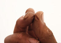
My finger cracks. They are rather painful. Keeping hands dry helps.
Superglue can also help as can liquid bandage - all things I've learned
since. I have also gotten these on canoe expeditions.
|
We had good light at the layover so I took quite a few photos. The
identifications are based on attempts to duplicate the view with
Google Earth ground view. This is looking up the East Fork of the
Kahiltna.
|
This is looking back toward the Denali Summit with the Kahiltna Peaks
closer to us.
|

This appears to be Mt. Frances with Mt. Hunter in the background.
|
Again looking back toward the summit of Denali.
|
Mt Frances with our route around to the right and behind to the airstrip.
|
Mt. Hunter in the evening.
|
Back at the landing strip. We dragged in at about 3 am.
|
The ranger camp at the landing strip.
|
Dave waiting for the plane with our gear packed and ready to go.
|
Our flight arrives.
|
Doug Geeting on the East Fork of the Kahiltna Galacier, here to pick
us up.
|
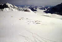
A scene from the flight out. Someone has climbed the glacier in the
middle of the picture judging by the tracks.
|
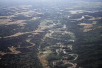
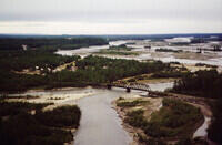
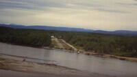
The lowlands and a river between Denali and Talkeetna. I haven't
matched this to Google Earth yet.
|
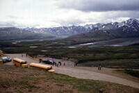
This photo was taken during the bus tour of Denali National Park along
the Denali Park Road to the north of the mountain. Only a few cars were
allowed on the road, mainly those with camping reservations for the
campgrounds. All the day-trippers ride the bus - generally these
school buses. One advantage of the bus is that you have many eyes
watching for animals and when one is seen, the bus stops for viewing. I'm
not sure if the system has changed in the many years since we were there.
|
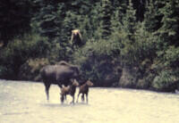
A highlight of the bus ride was when we stopped on a bridge and saw this
mother moose trying to protect her calves from a bear. I got this
dramatic photo of the encounter. One the biggest photographic disappointments
I've had is when I found out it was out of focus. But it's still interesting.
|
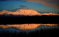
After dropping Bob and Dave at the airport and picking up Joan, we went
back to the Denali Park road and got camping permits for 3 nights, including
one at Wonder Lake at the end of the road. That allowed us to drive
ourselves all the way out. In the middle of the night, there was a commotion
in camp which was annoying until we saw the reason. This is one of the large
number of photos taken that night.
|
RETURN TO PREVIOUS INDEX