Navigation: Index page
Gila Wilderness Backpack April 2021
I did a five day backpack in the Gila Wilderness during the COVID
pandemic in April 2021. I was vaccinated in mid March so felt ok
about getting farther from home, especially since I would not need to
interact significantly with other people. My vehicle (1999 Chevy
Suburban) has enough range to do the whole trip without getting gas.
I drove to the Gila Cliff Dwellings National Monument on Monday April
19 and hiked about 5 miles up the West Fork of the Gila River to a
camp. The following day, I hiked up the West Fork to Hells Hole,
about 7 miles. There are reputed to be 51 river crossings on this
trail, although I didn't count. I was using new Keen SOLR sandals and
neoprene socks which turned out to be a good combination that allowed
me to tromp through the river crossings barely slowing down. The
third day, I hiked over the hight of land between the forks, via Prior
Creek and Cabin, to the Middle Fork of the Gila River at the Meadows.
I still used the sandals, but with heavy socks. That also worked well.
I camped at the Meadows with a party that I had been encountering
repeatedly during Tuesday and Wednesday. The following day, I hiked
down the Middle Fork to the bottom of the Little Bear trail. Along
the way, I stopped at the Jordan Hot Spring, which was very nice,
although a bit populated. Finally on Friday, April 23, I hiked back
to the West Fork over the scenic Little Bear Trail and reached the car
at about 10:30 am. I then drove home. This was a very nice trip, and
yet another for my 49 year old Kelty frame pack. The total distance,
adding map segments, is 37 miles which is pretty relaxed for 2 half
days and 3 full days. The first picture is a map of the route.
A few days after the trip, it became apparent that I was going to pay
a price for the good time. I had poison ivy. I had seen it in
several places but thought I had avoided it. Guess not. Some of the
plants I saw had very young leaves. The sticks also carry the
offending oil so I might have gotten it from a plant that had not yet
put out its leaves. There was also a lot of Box Elder, which looks
somewhat similar. But I knew the trick of telling them apart by how
the leaf clusters come off the main stems (opposite for box elder,
alternating for poison ivy).
The Gila Wilderness hike.
Click on the image for a screen size version.
The "2000" and "full size" versions are larger (not available in web versions).
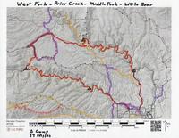
This map shows my hike in red. The original map is at the
"interactive map" link at the web site
https://heartofthegila.org/trail-info/. That map uses an annotated
caltopo.com map to show trail conditions, as indicated by the other
colors. The triangles mark my four campsites. The first, third, and
fifth days were mostly on dry land. The second and fourth days were
following the West and Middle Forks of the Gila River and involved a
large number of river crossings.
|
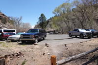
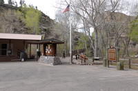
The trail head parking just beyond the Gila Cliff Dwellings visitor
center and start of the trail to the Cliff Dwellings. My car is the
blue Suburban. There were signs at the trailhead warning of cougars
and that this is a Mexican Wolf reintroduction area. Curiously, there
was no sign about bears, although they are there.
|
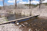
The first few stream crossings, before some branch trails, had logs
set as bridges. So I was using wool instead of neoprene socks for
a while.
|
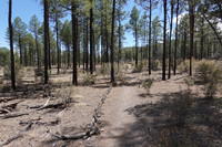
The trail was in fairly level open forest in a wide valley near the
start.
|
The log bridges got more marginal as the canyon closed in.
|
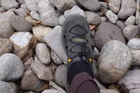
Time for the neoprene. This combination of neoprene sock and Keen SOLR
sandals worked extremely well with the frequent river crossings.
|
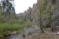
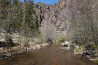
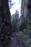
Much of the canyon had vertical sides with the river bouncing between
the cliff faces. Each time it did that, the trail had to cross as it
is about to do here.
|
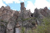
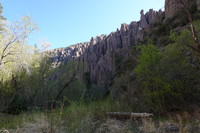
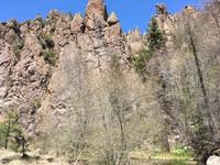
An interesting segment of the cliffs along the river. A cave, a rock
pilar, and multiple rock layers are visible.
|
A peaceful river scene from half way across one of the crossings.
|
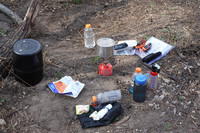
At my first camp getting ready for dinner. My typical dinner was a
Mountain House freeze dried meal, an Aussie Bite and whatever left
over gatoraid (powdered after the first day) and lunch snacks I had.
I only boiled water. In addition to paper maps, I used an iPhone SE
for navigation with apps that support downloaded maps. I used the
InReach Mini to communicate daily with my wife Joan and as a possible
emergency beacon. The Steripen was my method for water purification.
I had both bear cannister and spray. If I did it again, I would
probably take the spray but use tree hangs instead of the cannister.
|
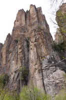
The cliffs above camp.
|
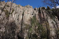
Some interesting cliffs along the trail.
|
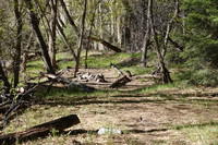
There was an occasional really nice established campsite. Unfortunately
they did not appear at the times I wanted them.
|
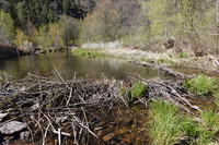
There was a moderate amount of beaver activity along the river.
|
Another mid-crossing photo of river and cliffs.
|
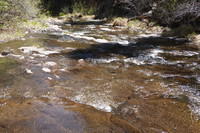
A stretch of river with more slab rocks than the usual big gravel.
Unfortunately one of the slabs was very slippery and I went down in
the water getting my camera wet. I removed the battery and let it
dry for a few hours to try to avoid problems. That worked and I used
it for the rest of the trip after that evening. I used the iPhone for
a few photos while the Sony was drying.
|
An iPhone photo of the river and some interesting formations.
|
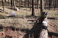
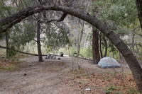
My camp in the Hell's Hole area. I never did put the fly on the tent
on this trip. It did not threaten to rain.
|
Climbing up out of the West Fork canyon on the morning of day 3. The
climb was a bit over 1000 ft.
|
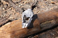
An old skull along the trail through the flatish country between the
forks of the Gila.
|
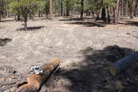
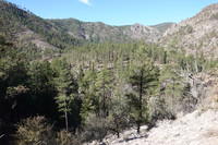
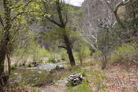
This gives a better idea of the country at the skull. It is open forest.
Everything seems very dry. The river did not have its usual spring
runoff spike this year.
|
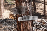
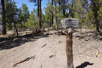
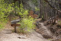
Fairly typical trail sign, this one at the junction of the Woodland trail
and the Prior Creek trail.
|
Prior cabin along Prior Creek, which is in the foreground - obviously
dry. We saw a bit of seepage at a spring upstream from here. The
stream supposedly gets perennial downstream a ways but I didn't check
it out. The trail toward the Meadows on the Middle Fork takes off up
the hill behind the cabin. It took a while to find it. This was one
of several places I encountered a group from Bloomfield, NM. I ended
up camping with them at the Meadows.
|
Some interesting trees not far before the junction with the trail that
comes up from the Meadows.
|
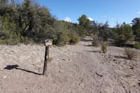
We were worried about possibly missing the junction, but it turned out
to be very obvious, with a big clearing and an impossible-to-miss sign.
|
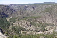
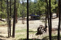
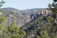
Not far from the junction, there is a nice rock outcropping at the edge
of the Middle Fork canyon that provides a good view. The Meadows, where
I and the other group camped is at the bottom center of the photo.
|
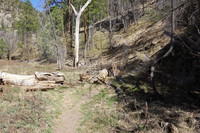
The descent was a bit interesting but I didn't have any trouble until this
stretch just as it reaches the valley floor. There some rocks rolled under
my feet and I sat down. The campsite is right behind me.
|
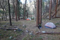
My third camp, which was near the Bloomfield group. Note my 49 year
old Kelty frame pack that is still going strong. I bought it in 1972,
if I remember correctly, and have used it ever since. See the 1975 Mt
Vancouver expedition and the 2003 Sierra Hike slide sets for other
trips where I used it. It does have significantly upgraded
belt and shoulder straps but the frame and bag are original. FYI it
weighs 5 pounds which is in the range of other packs that can handle
serious loads. I've carried in the neighborhood of 100 pounds several
times on climbing and canoeing trips.
|
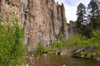
Along the Middle Fork.
|
Another stretch along the base of some cliffs.
|
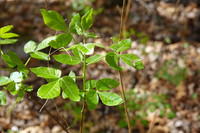
Poinson Ivy! I didn't know it until a few days after the trip, but I clearly
tangled with some and got big rashes on the right side of my hip, on my belly,
and on the inside of my right ankle. I am suspicious that I had a contaminated
shirt sleeve on a bathroom break somewhere. Note how the clusters of 3 leaves
come off the main stem alternating from side to side.
|
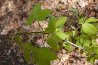
Box Elder. This plant also has three leaves, but note how the clusters come
off the main stem opposite each other. That is the key to telling it
from poison ivy. This plant is benign, and there is much more of it than
poison ivy, especially along the West Fork.
|
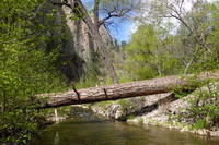
A particularly good log bridge not far from Jordan Hot Springs. This one
clearly was not intentionally placed - it is way too big.
|
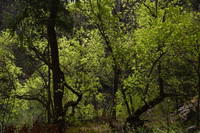
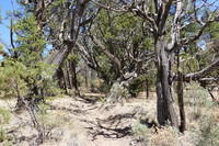
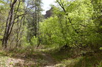
Light in the trees.
|
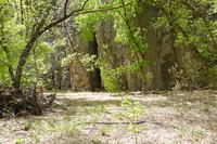
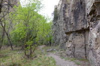
A nice stretch along the cliffs.
|
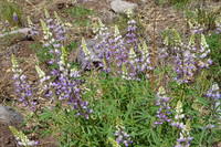
Some lupine.
|
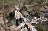
Me standing at Jordan Hot Springs. I took the opportunity to clean
my clothes by wearing them in the spring. The water was warm, but not
very hot. I almost measured the temperature but broke my thermometer
in the process. This was a very pleasant pool with clear, clean water.
|
A river crossing downstream from the hot springs.
|
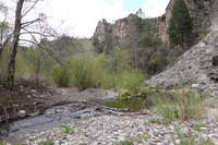
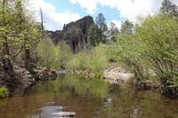
Middle Fork of the Gila and cliffs near the junction with Little Bear
Canyon.
|
The junction of the Middle Fork trail and the Little Bear trail. I camped
near here, then walked out over the Little Bear trail the last day.
|
My camp near the junction. There was room for many camps here.
|
Cliffs across from camp.
|
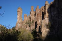
Some of the interesting formations near the camp.
|
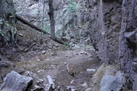
In Little Bear Canyon.
|
Another in Little Bear Canyon.
|
A view along the Little Bear trail.
|
A trail junction about half way along the Little Bear Canyon
trail between the Middle and West forks of the Gila.
|
Back at the Cliff Dwellings visitor center and trail.
|
Navigation: Index page