Navigation: Index page
Snake River in Hells Canyon, 2022
The photos linked here were taken during our run of Hells Canyon of
the Snake River between June 28 and July 7, 2022. The crew were
friends from Nanaimo, BC, and myself, Craig Walker, from Socorro, NM.
The Nanimo group were Gill, Joe, Nora and Phoebe Box, Kerry and Sharon
Luttrell, Mike, Elaine (Gardem), Katie, and Adam McCulloch, and Matt,
Melissa (Gillis), and Elsie Feagan. I've been on several previous trips with
all but the Feagans. Kerry and I have done many trips together since
1987 when we met canoeing the Coppermine river in the Northwest
Territories.
Thanks to which lottery we won (Thanks Elaine), we ended up doing
Hells Canyon again despite having done it in 2017. That was, in fact
my last big river trip. The water levels were slightly lower this time
and I had the sense that the rapids were not as powerful. That might
be influenced by the fact that I was not expecting such big water the
first time. I knew what to expect this trip.
I have several movies but have not included them in the web version
because of their size. The movies are mostly of messing around in
camp. We tried to keep the boats together in the rapids so I was
rowing rather than photographing during the more exciting bits. I
have include two pictures of me in whitewater that were taken by Matt
Feagan.
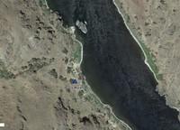
I have also included screen grabs of satellite images obtained from
the us0.explore.garmin.com web site referenced in the inReach messages
sent to my wife each evening. Garmin has marked my location when the
message was sent, generally either from my tent or the kitchen. So
these show our campsites. I have put them as the first photo from
each camp.
Click on the image for a screen size version.
The "2000" and "full size" versions are larger (not available in web versions).
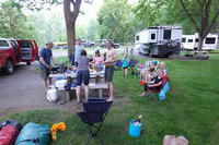
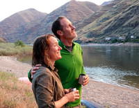
The crew met at the Copperfield Campground the night of June 27 where we
had a communal dinner. We got up very early the next morning to be able to
cross Hells Canyon dam before it was closed for maintenance.
|
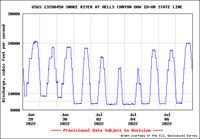
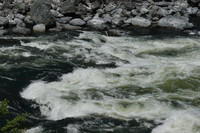
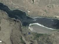
The water level just below Hells Canyon Dam during our trip. The influence of
the varying demand for power is clear.
|
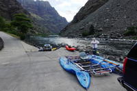
The launch ramp at the end of the road just below the Hells Canyon Dam.
There is another area for rafts, but with the road closed on the dam, no one
else wanted the ramp.
|
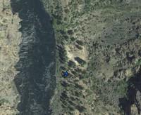
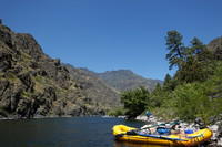
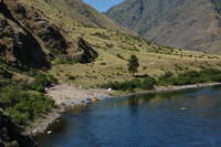
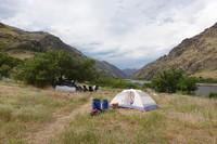
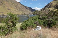
June 28 campsite - Warm Springs. This site has a rocky landing, and
big open area well above the river. From the Garmin inReach web site.
|
At the rather rocky landing for the Warm Springs camp.
|
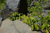
There was a lot of this plant about. I believe it is poison ivy based
on 3 leaves and the berries. But the attachments of the leaf clusters
to the main stem is not what I've seen before. I'm not aware that
anyone was affected.
|
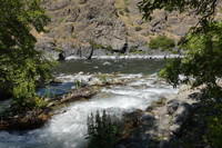
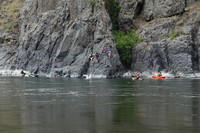
Scouting Wild Sheep Rapid (IV), one of the two biggest rapids of the trip.
|
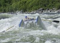
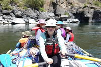
Photo of me in, I believe, Wild Sheep Rapid, taken by Matt Feagan from his
kayak.
|
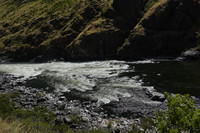
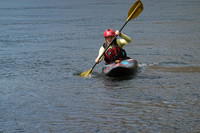
Scouting Granite rapid (IV), the other big rapid. Most of the big whitewater
was done during the second day.
|
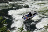
A jet boat heading down Granite Rapid. We also saw one going up.
|
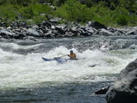
Photo of me in, I believe, Granite Rapid, taken by Matt Feagan from his
kayak.
|
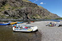
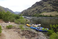
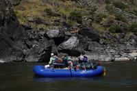
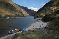
At our lunch break.
|
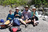
The McCulloch family having lunch.
|
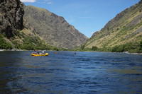
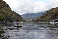
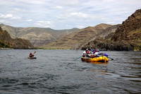
On the river
|
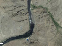
June 29 and 30 campsite: Johnson Bar Landing. Sheep Creek is at the
top. There is a lodge where the grassy field is seen. From the
Garmin inReach web site.
|
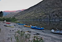
Morning at the Johnson Bar Landing campsite. Note how high above the water
the boats are. They were tied up in the afternoon at the waterline. Hat
Point Lookout (see next photo) is on the high point at the left end of the
sunlit ridge.
|
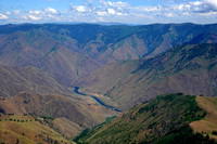
The Johnson Bar campsite is at the final bend seen in this photo taken by me
after the river trip from the Hat Point Lookout. The elevation difference
between the river and Hat Point is similar to that of the South Rim of
the Grand Canyon. But somehow it doesn't look as impressive.
|
The Johnson Bar Landing campsite, with Elaine, I think, using the paddle board.
This was taken from the trail to Sheep Creek.
|
Sheep Creek entering the river. It is an easy hike to the creek from our camp.
|
The facility at Sheep Creek. The large sign on the building points to the
rest room.
|
Various of the crew jumping off the rocks on the other side of the river
from Johnson Bar during our rest day. I have a movie of this activity.
|
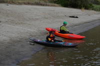
Katie playing with Gill's kayak.
|
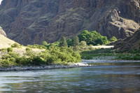
Looking downstream from Johnson Bar toward Sheep Creek.
|
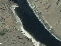
The Hominy Bar campsite that we used the night of July 1 (Canada Day!).
From the Garmin inReach web site.
|
Everyone except me (taking picture) and one kid at dinner at Hominy Bar.
|
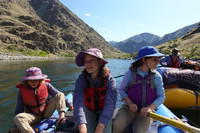
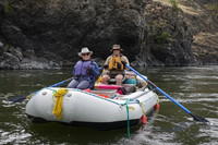
Pheobe, Nora, and Elsie on my raft doing two person rowing.
|
Katie rowing my boat with a full load of kids.
|
The Camp Creek site used on July 2. From the Garmin inReach web site.
|
My tent at Camp Creek.
|
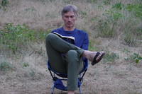
A hard day on the river! Matt reading.
|

Katie and Elaine at Camp Creek.
|
The boats at camp creek. The line of rocks is meant to keep people out
of a mud wasp nest
|
The Bar Creek campsite that we used on July 3. Note that there are
structures on the other side of the river here. From the Garmin
inReach web site.
|
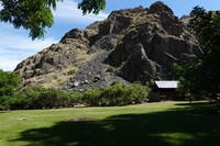
The kitchen at Bar Creek.
|
The camp at Bar Creek. My cataraft is visible through the trees. The
biggest tree hides the structure across the river.
|
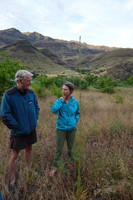
The two doctors on the trip - Kerry and Malissa.
|
Sunset at Bar Creek. We did have some rain.
|
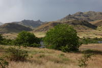
Along the river after Bar Creek
|
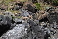
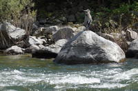
Mountain sheep along the river.
|
The mountain sheep again with the McCulloch raft in the foreground.
|
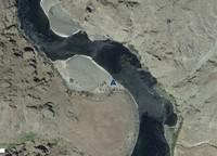
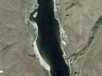
Our July 4 campsite at Geneva Bar. From the Garmin inReach web site.
|
For those not familiar with river travel in the high use era, this is
the portable toilet (groover) all parties are required to carry. Here
it is deployed and ready to use just out of sight above camp.
|
The Geneva Bar campsite.
|
Sharon and Kerry on their boat the next day.
|
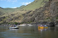
The Luttrel and Box boats with all of the kids on the Box boat.
|
A heron beside the river. To get this photo, I had to let go the oars
in a minor rapid.
|
The Camp 175.4 campsite where we spent the nights of July 5 and 6.
This was the last camp. Note civilization is encroaching. The camp
is on BLM land but there are a number of houses on the other side
includeing one under construction. From the Garmin inReach web site.
|
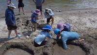
The kids had quite a project to build holding ponds on the beach above the
river, then punch holes and watch the mini-river erode a channel. This
is a frame from a movie I have of the process. It is nearly 200 MB so I
have not included it in the web show. Any suggestions on a good compression
scheme?
|
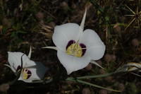
A sego lily if my Google Search worked. Apparently it is the state flower
of Utah.
|
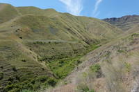
I took a walk above camp and eventually crossed this stream bed.
There was a bit of water but it soaked in before reaching the river.
The plants in the bottom of the little valley were berry bushes. I
got pretty scratched up crossing the valley.
|
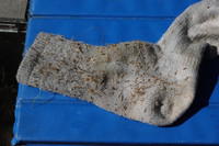
It took several hours to remove all the seeds from my socks from my
one hour hike.
|
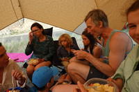
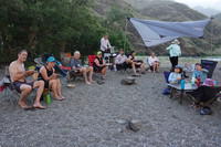
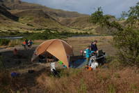
A rain shower caught us at dinner. My Kelty Sunshade was up next
to the kitchen so all 14 of us, all on chairs, squeezed in. I wouldn't
have believed it would work, but it did.
|
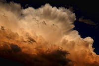
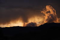
There was a rather spectacular sunset. Click
here for a larger version that looks
good on a full screen.
|
Gill and Joe watching the sunset.
|
Gill and Matt preparing for the final paddle to the takeout at Heller Bar.
|
Near the end.
|