RETURN TO PREVIOUS INDEX
Lower Salmon River in July 2023
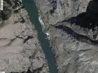
The Lower Salmon River, the stretch ending at the confluence with
the Snake, is a fine rafting opportunity that does not require winning
a lottery. In 2023, none of our group obtained a lottery permit for
any of the 6 rivers for which all of the adults in our group applied.
After some Internet research, we decided to run the Lower Salmon from
Shorts Bar, just upstream of Riggins, ID, to Heller Bar about 20 miles
on the Snake River downsteam from the confluence. We were already
familiar with that stretch of the Snake and with Heller Bar because
that was the takeout for our last two trips, both through Hell's
Canyon.
The group was basically the same as for the Snake and Grande Ronde
trips. All but me are from Nanaimo, BC. They are Kerry and Sharon
Luttrell; Gill, Joe, Nora, and Pheobe Box; Mike, Elaine (Gardem),
Katie, and Adam McCulloch; and Matt and Elsie Feagan. This is a
three generation trip since Kerry and Sharon are Gill's parents. I
am Kerry's age and have known him since a Coppermine River canoe trip
in 1987.
The Lower Salmon has a little more civilization along its shores
than the rivers that require permits, at least for the upper half of
what we did. Between Riggins and White Bird, US 95 is on one side.
There are various river access points and other roads and bridges.
But it is not oppressive. Below White Bird the river is more
isolated.
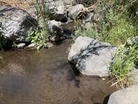
The Salmon is a naturally flowing river. There are no dams
upstream. This has two important effects. There are many fine sand
beaches that make good campsites. And the flow varies a great deal
from spring to summer. There is one rapid, the Slide, that is
extremely dangerous above about 20000 cfs (at the White Bird gauge)
and a mild riffle below about 10000 cfs. It is in a wilderness
stretch and a portage would be extremely hard. So there is basically
an earliest date, that varies from year to year, before which the
stretch should not be run. That date is typically near the beginning
of July. The combination of an earliest, but variable, safe date with
adequate camp opportunities may help account for the lack of a lottery.
During our trip, the White Bird Gauge reading slowly dropped from
10200 cfs to 7500. It was 7700 when we passed the Slide. The water
temperature was between 68 and 70 deg Fahrenheit (20 and 21 deg
Celsius) at the gauge, which was nice for swimming. We thought that
the water level we had was nearly ideal - low enough to not be scary,
high enough to not be bony. Of course, none of us have experienced
this river at other water levels so that is just a guess. We were
lucky - the river usually transitions from too high to it's summer
level near 5000 or less fairly rapidly. Trying to hit the optimum
while planning well ahead would be tricky.
I left home on July 8 and camped at Green River State Park in Utah.
The following day, I drove to Three Island Crossing State Park in
Idaho where I again camped. On July 10 I drove to Shorts Bar just
upstream of Riggins on the Salmon River where I met the rest of the
crew. Actually, I first went farther north to White Bird where I
signed in with the shuttle service and encountered the Luttrells. We
looked at some of the rapids during the drive back to Shorts Bar. We
launched from Shorts Bar on July 11. See comments among the photos
for the rest of the river camps.
We got off the river on July 19 at Heller Bar and most of us spent
the night together at the River Tree Inn in Clarkston, Washington.
The following morning the Canadians headed northwest while I headed
east to drive the Magruder Corridor, a 100 mile dirt road sandwiched
between the Frank Church River of No Return and the Selway Bitterroot
Wildernesses. I spent the night at Poet Creek Campground near the
start of the Corridor road. Unfortunately much of the beauty of the
area was degraded by recent fires. After returning to the highways, I
went directly home with hotel stays in Challis, ID, and Green River,
UT. This was the first trip with my new Ford Ranger and it went well,
except that the Yakima clips on the front crossbar kept trying to work
loose. After the trip, I replaced that system with a bolted on track
and "landing pads". I secured the rack for the drive home with NRS
straps.
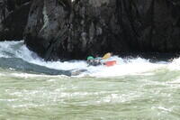
I have a hard time getting pictures of us in the whitewater on
these trips because I am rowing one of the rafts and my cameras are
not waterproof. Also we like to keep the rafts near each other in the
rapids. But Matt sent me 4 pictures taken from his kayak to give a
small taste of the whitewater. They are credited in the comments with
the photos. I did what I could to determine which rapids they were
taken in. His photo of the Box boat was clearly taken in Snow Hole
rapid, for which I have a scouting picture. The time offset there is
pretty clearly 2 hours so I assumed that for the other photos as well
(PST vs MDT?). My identifications of the rapids for the other photos
are based on that offset and the known locations of some of my photos.
Each night on the river, I sent Joan (my wife who doesn't do river
trips any more) an inReach message via satellite. Those generated
emails that have links to maps that show were we were. I have zoomed
in on the satellite images available at the Garmin site and made
overhead shots of each camp, which are included below. The waypoint
"Craig Walker" shown in each is the location of my inReach device when
the message was sent. They seem very accurate.
Most of the photos here were taken with my Sony RX100VII. A very small
number were taken with my iPhone, as noted. Plus there are the four
provided by Matt Feagan - thank you Matt.
This is the web version the slide show from his trip. I have
a similar show with all my photos but it is not accessible from
the Internet. It includes larger versions of the photos.
Click on the image for a screen size version.
The "2000" and "full size" versions are larger (not available in web versions).
My campsite at Green River State Park on the night of July 8.
|
My campsite at Three Island Crossing State Park before setting up the tent
in the grass on the camera side of the table. This was the night of
July 9.
|
This is Time Zone Rapid just upstream of the US95 bridge as seen from
the highway while driving between White Bird and our launch site at
Shorts Bar.. This may be the hardest rapids of the Riggins to Hammer
Creek section although Traps Creek has the same III-IV rating and I
don't remember it well.
|
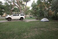
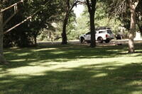
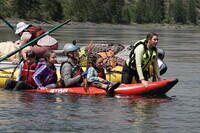
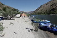
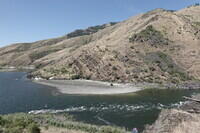
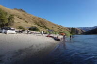
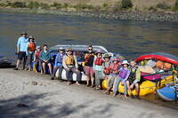
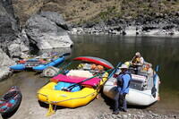
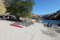
Meeting at Shorts Bar. This was our campsite. Shade was a premium as it
was hot. The whole trip was hot! Shorts Bar is at mile 88 in the BLM Lower
Salmon River guide book. Zero is at the confluence with the Snake.
|
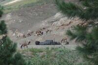
A herd of elk came near the Shorts Bar camp.
|
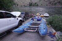
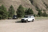
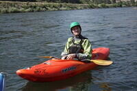
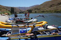
Launch preparations. My boat is the cataraft in the foreground.
|
July 11: Shorts Bar to Johnson Bar.
|
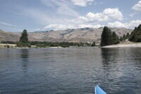
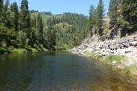
Along the river. US 95 is on the right side.
|
Another along the river.
|
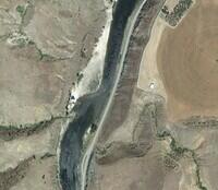
Satellite image of our campsite at Johnson Bar at about mile 73.6. This is
not a marked campsite in the guide.
|
The Johnson Bar campsite. Note US 95 on the opposite side.
|

Kerry and Sharon Luttrell at Johnson Bar.
|
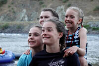
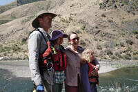
The four girls. Katie and Pheobe in back, Elsie and Nora in front.
|
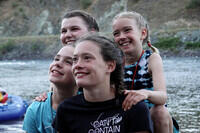
An alternate version of the four girls.
|
July 12: Johnson Bar to Big Rock Campsite
|
Matt in his kayak. Gill was also in a kayak but I don't have
pictures.
|
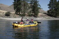
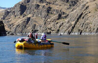
The Box boat somewhere along the river.
|
Nora rowing the Box boat.
|
Near Twin Bridges and Russell Bar.
|
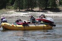
Trying to sink the smaller IK.
|
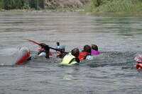
The outcome of too many people on the IK.
|
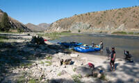
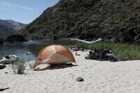
We stayed at the Big Rock campsite, at mile 50.1, on the nights of
July 12 and July 13. We did our first of two layovers here. This is
the photo from the inReach site.
|
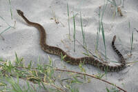
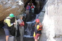
I put the groover in a nice, if a bit brushy area up behind camp. Soon this
rattlesnake was found along the trail to it. The groover got moved to a
site closer to shore and we used the privacy tent.
|
The Big Rock campsite.
|
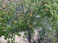
There were reports of apricot trees downstream of camp. Kerry and I
went looking and found them. I only had my phone with me so these
are iPhone photos.
|
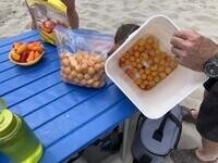
We brought some apricots back to camp for everyone. iPhone photo.
|
July 14: Big Rock to Upper Pipeline campsite.
|
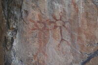
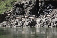
Some pictographs at a site marked in the BLM guide book.
|
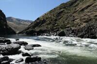
The river from the pictograph site.
|
The Boxes at the pictograph site.
|
The Luttrells and granddaughters at the pictograph site.
|
The McCullochs at the pictograph site.
|
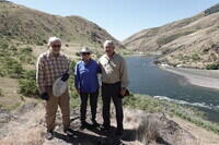
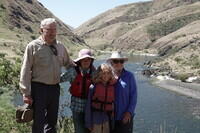
The seniors of the group - Craig and the Luttrells - at the pictograph site.
|
The Luttrells entering a rapid, probably Wright-Way Rapid.
|
Me about to hit the bigger waves in the same rapid.
|
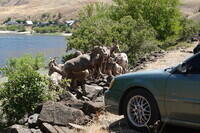
Bighorn sheep along the river. This looks to be all females and young.
|
inReach shot of Upper Pipeline Campsite on July 14 at mile 30.9.
|
Upper Pipeline camp.
|
Matt hero picture, although it turns out he was capsizing.
|
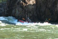
Joe heading into the wave with the IK. Matt waiting in the eddy.
|
|
July 15: Upper Pipeline to Lorna's Lulu Beach campsite at mile 29.3.
|
inReach shot of Lorna's Lulu Beach campsite at mile 29.3. It seems we
only made 1.6 miles from Upper Pipeline. We made it almost like a
layover day, although I thought we did more than that. Later in the
day, another party claimed the upper end of the sand bar.
|
Lorna's Lulu Beach campsite.
|
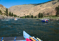
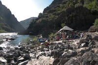
July 16: Lorna's Lulu Beach to Growler campsite. The big rapids are this day.
|
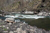
Scouting Snow Hole rapid.
|
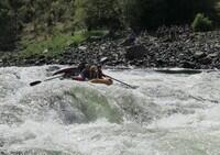
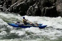
Photo by Matt Feagan of the Box boat in Snow Hole rapid.
|
Scouting the upper part of China Rapids.
|
Scouting the lower part of China Rapids.
|
inReach shot of the Growler campsite used on July 16 and July 17 at
mile 12.2
|
Growler campsite looking upstream.
|
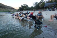
Dealing with the heat at dinner at the growler camp.
|
July 17: Layover day.
|
Morning shot at the Growler camp.
|
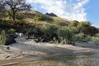
The scenic, riverside groover site at Growler camp.
|
The kids jumping from the boats at Growler camp.
|
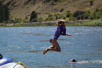
Pheobe in mid jump.
|
Growler camp in the evening.
|
July 18: Growler campsite on the Salmon to Upper Cottonwood campsite on the
Snake River.
|
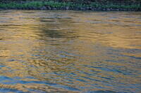
Reflections.
|
Morning at Growler camp.
|
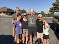
Ready to go. Left to right: Mike, Elaine, Adam, Katie, Sharon, Kerry, Gill,
Nora, Joe, Pheobe, Elsie, Matt.
|
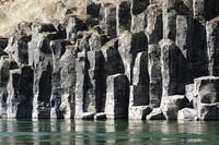
Some columnar basalt along the river.
|
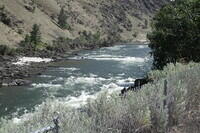
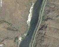
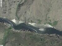
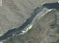
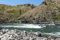
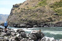
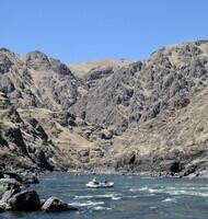
The site of the Slide Rapid at mile 3.5. This is nothing below 10k
cfs, but deadly above 20k cfs. The canyon walls make something of a
funnel here and the rocks in the slide on the left make big holes.
The water level when we were there on July 18 was 7700 cfs so well in
the safe range.
|
Zooming in on Slide rapid.
|
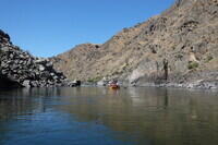
A photo by Matt Feagan of a stretch of mild rapids. The timing
compared to my photos suggests that this is downstream of but near
Slide rapid, assuming the about 2 hour offset determined at Snow Hole.
|
Cherry Creek at mile 185.9 on the Snake. This is a good place to get
water.
|
The boats parked at Cherry Creek.
|
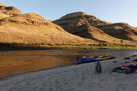
inReach shot of the Upper Cottonwood Creek camp on the Snake River at
Snake River mile 181.1. Used July 18 the night before takeout.
|
There was a small amount of water flowing in Cottonwood Creek. We
could probably have collected water here. iPhone photo.
|
View of most of the Upper Cottonwood Creek camp, although several tents are
uphill behind the camera. The large cylindar beyond the kayak is a boiler
from the steamer Imnaha that supplied the mines at Eureka, shortly upstream
of the Snake/Salmon confluence, in 1903. It broke up in Mountain Sheep Rapid
(Class II) after a line fouled it's paddle wheel and set it adrift. A Google
search gets various articles including one in the Wikipedia.
|
July 19: Takeout day.
|
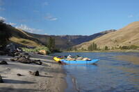
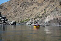
The Box boat on the final run down the Snake.
|
Across Corral Creek campsite which was our last camp on both Hell's Canyon
trips. It is also called Camp 175.4. We didn't use it this time.
|
The welcome party at Heller Bar. I don't have other shots of the scramble
to load boats and gear into the vehicles. I was also fighting to contrive
a scheme to secure my rack to my car. Its clips were not holding on the
door jams of the Ranger.
|
iPhone photo of the Luttrell/Box clan preparing to leave Clarkston.
|
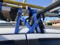
The straps holding my rack in place for the trip home. One strap goes over
the clip helping hold it in place. Both straps go around the B pillar where
the side curtain airbag is located - probably not good in a crash.
|
|
July 20: Start of Magruder Corridor. First some photos taken on the drive
to the start. I am alone for the rest of the trip - heading south to
New Mexico while the others head north to BC.
|
On highway 14 along the South Fork of the Clearwater River. Rather
pretty drive.
|
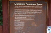
The sign describing the Magruder Corridor Road.
|
The turn off onto the Magruder Corridor Road.
|
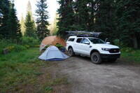
My camp at Poet Creek Campground about 25 miles into the 101 mile Corridor
road. I had rain at this camp and also more altitude than on the river.
It felt good to be cool!
|
July 21: Drive over the rest of the Magruder Corridor and on to Challis.
|
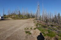
There was a lot of fire damage along the Corridor.
|
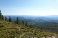
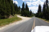
This photo gives an idea of the type of country the road goes through.
|
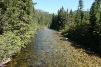
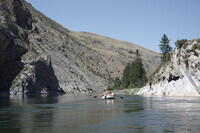
The road eventually crosses, then follows for a while, the Selway River.
|
End of photos for the trip for the web version.
|
RETURN TO PREVIOUS INDEX