Navigation: Index page
The Green River in Labyrinth and Stillwater Canyons
The Green River flows 123 miles from the town of Green River, Utah,
through Labyrinth and Stillwater Canyons to the confluence with the
Colorado River, in the heart of Canyonlands National Park. There are
no rapids so the trip is suitable for many kinds of craft with canoes
and sea kayaks being the most common. The country is isolated for the
most part, with just a few lightly traveled, rough roads reaching the
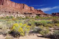
river. Typical for the Canyonlands region, the scenery is
spectacular. Permits are required, but easy to get with no lotteries
or waiting lists. There is one logistical complication. Once you
reach the confluence, you can go four more miles to Spanish Bottom
easily. But you are a long way from roads that reach the river and
downstream is Cataract Canyon with its huge rapids - not a place for
the boats most appropriate for the trip to that point. The usual
solution is to get a jet boat operating out of Moab to come down the
Colorado and take you back to civilization. The Labyrinth/Stillwater
run is a long, but low stress, wilderness trip for those competent in
the outdoors and small boats.
During the second half of October, 2011, Kerry Luttrell, Ron Thomas,
Janet Brook, Mary Nutt, and I (Craig Walker) ran the Green River from
Ruby Ranch, 23 miles below Green River to Spanish Bottom. We had an
extended stay at Trin Alcove and layover days for hiking at Anderson
Bottom and Spanish Bottom. The jet boat trip out with Tag-a-Long
Expeditions took most of the last of the 10 days we were on the trip.
All of us had been together on several previous trips, some
significantly longer and most involving whitewater canoeing or
rafting, so this was a pretty relaxed affair.
We used two expedition canoes, the Old Town Trippers that Kerry and
I have taken on several arctic canoe trips. For the odd person
(rotated), we brought my Feathercraft K1, a folding sea kayak. The
land managers require the use of portable toilets and a firepan and
the desert environment, combined with silt-laden river, caused us to
bring considerable water. We also brought a cooler, which we've
gotten used to on raft trips. All this extra gear, and no real
attempt to utilize the space in the kayak effectively meant that the
canoes were piled pretty high with gear - much more than we've had on
3 week northern expeditions!
The photos below are a selection from those I took. I had
purchased a new camera shortly before the trip - a Pentax K5. I used
both it and my old Pentax K10D, along with various lenses that I've
accumulated over the years. The K5 has more pixels, but the K10D
holds its own pretty well in good light. I typically carried the K10D
with my 55-300mm zoom to be prepared for wildlife. Unfortunately we
didn't see much. The K5 usually had the 12-24mm wide angle mounted,
but sometimes, especially on hikes, I went with my smaller "Limited"
prime lenses. While the K10D does well in good light, the K5 is much
better under more difficult photographic conditions.
This year was a big one for water flows. We had something like
4500 cfs during our trip, compared to long term averages for those
days of the year of about 2700. The water was flowing at about 2mph
when we measured it with our GPS units and there were some sandbars
suitable for camping. We hit shallow water a few times, usually by
making a wrong choice of path. But clearly larger boats could get
through easily at this level. It would be interesting to see the
river at low water. Temperatures ranged from just below freezing on
the coldest nights to room temperatures during the days. It was clear
and calm most of the trip, with some stormy weather at the end. The
days were getting short, which limited our daily mileages. Making 20
miles in a day was not too difficult, but required being careful not
to spend too much time on the scenic stops. We often did less.
Navigation: Index page
Click on the image for a screen size version.
The "2000" and "full size" versions are larger (not available in web versions).
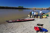
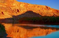
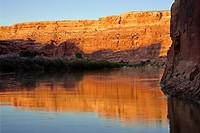
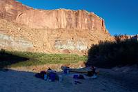
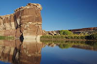
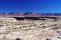
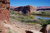
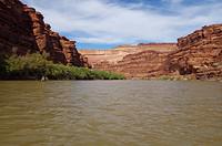
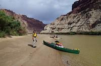
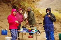
Starting the trip at Ruby Ranch. The boat in
the background belongs to a couple with whom
we shared our Tag-a-Long shuttle.
|
|
|
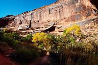
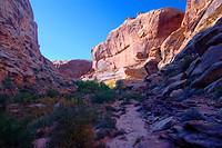
Walking up Three Canyon from Trin Alcove the
first afternoon (Oct 18). We camped on a
sand bar at Trin Alcove.
|
Along Three Canyon. There was clear water in
the stream which we used for drinking after treating with a
SteriPen.
|
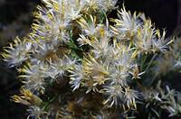
Some moss up a side canyon at a seep.
|
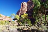
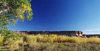
Near the mouth of Three Canyon.
|
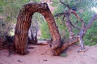
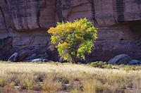
An odd tree that clearly got bent over in its
youth and put down new roots for a fresh start.
There was a nice campsite at this location a
short distance up Three Canyon from the river.
|
Morning from our riverside campsite.
|
Up one of the other canyons that came out at
Trin alcove. This one ended fairly quickly, unlike
Three Canyon.
|
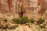
Some structure in the rock in the side canyon at Trin
Alcove.
|
|
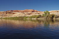
The view upriver in the evening from the second camp.
If you look closely, you can see boats from another
party on the sandbar on the other side.
|
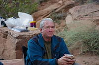
Kerry at the second camp.
|
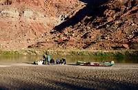
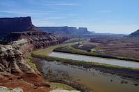
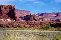
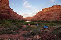
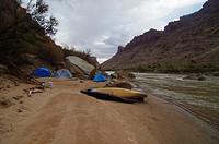
Our third camp on a large sand bar in the middle of Bowknot Bend.
The tents were on slightly higher ground near the tamarisk jungle
that lines the river.
|
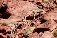
Some deer seen along the river on the fourth day (Oct 21).
|
Evening at the sand island camp used on Oct 21-22 near the
Canyonlands National Park boundary.
|
A photo from the site of an Anasazi tower above
Fort Bottom. It is clear that this was a good place
from which to keep an eye on the region.
|
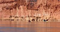
Looking back toward the narrow part of the river bow.
|
Looking down on the boats and basically upstream.
|
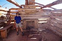
The Mark Walker cabin.
|
On the way back to the boats.
|
|
|
The view from where we tied up the boats at Anderson bottom.
|
From the camp at Anderson Bottom.
|
The Anderson Bottom camp where we spent two
nights.
|
|
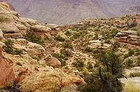
At the top of the trail from Anderson Bottom to the
higher country around. We needed to be a bit
careful that we could find the top of the trail again.
|
In the upper end of the canyon that the trail started in.
|
Anyone know what this is?
|
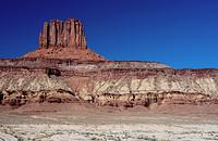
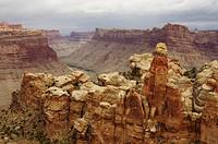
One of the Buttes of the Cross - that appear like a cross
when superimposed viewed from upriver.
|
Looking back toward Anderson Bottom and the river.
|
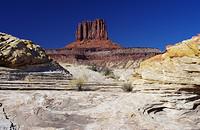
Another view of one of the Buttes of the Cross.
|
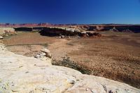
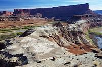
Anderson Bottom overview. Our camp was near the left most
area you can see in the bottom. Anderson Bottom is an old
cut-off oxbow.
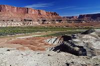
|
The area of the lower Anderson Bottom camp.
|
Looking upriver toward the upper Anderson Bottom sites, where
we stayed.
|
|
Along the cliffs behind and to the right of this tree is a spring
and a store room used by the Park Service for items related to the
Memorial Day "Friendship Cruise" of motorboats going from Moab to
Green River. We replenished our water from the spring, which you
have to climb up to.
|
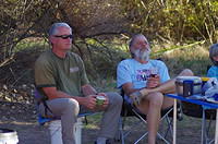
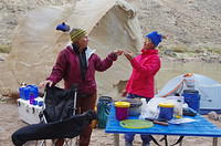
Kerry and Ron at Anderson Bottom.
|
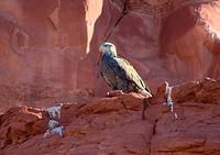
A nearly, but not quite, mature bald eagle.
|
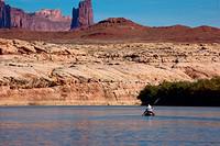
We landed at Turks head to check the granaries and
chert working areas. We landed on the south side.
This is the view from near there.
|
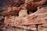
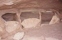
An Anasazi granary on Turks head.
|
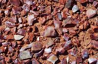
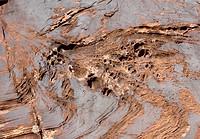
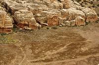
Some of the vast amount of chert which looks worked that
covered acres on Turks head.
|
|
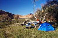
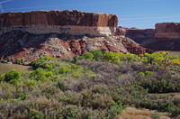
Our camp site at Jasper Canyon
|
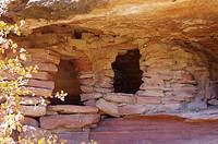
The Anasazi ruin in Jasper Canyon.
|
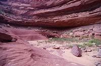
The end of easy travel shortly up Jasper Canyon.
|
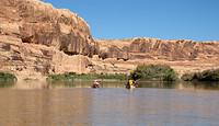
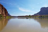
On the sandbar just below the confluence of the Green and Colorado.
|
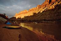
Our campsite at Spanish Bottom. This was where we had our only
bad weather at a camp. We did have some wind in the last couple
of days on the river. We stayed at this camp for two days, and
caught the jet boat at the site. It is slightly upriver from
the official upper Spanish Bottom site.
|
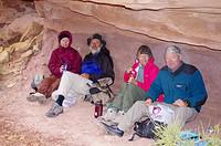
Mary and Janet at camp.
|
Evening at Spanish Bottom.
|
Eating in the rain at Spanish Bottom.
|
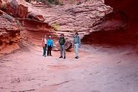
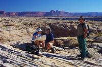
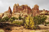
During our layover day, we hiked up to the Doll House in the
Maze District of Canyonlands. This photo was taken from the
rim looking down to the river.
|
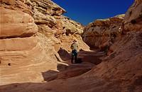
This is Surprise Canyon below the main Doll House region.
|
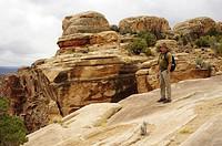
Kerry taking in the view toward the river.
|
The granaries that a trail from the Doll House goes to.
|
Lunch under an overhang while it rained. Kerry was convinced
the rains were over and didn't bring a rain coat. The southwesterners
weren't convinced so were better prepared.
|
In the Doll House area.
|
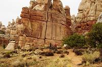
More Doll House.
|
A road reaches the Doll House and there are some official
campsites. This is near one. I saw one tent, but no
vehicles. It is not an easy road.
|
Starting back down to Spanish Bottom.
|
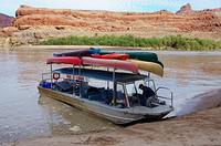
The jet boat at Potash after unloading passengers.
The boat was making about 30mph upriver. On this day, the jet boat had
20 passengers. Ours was the largest party at 5. There was a group of
4 and most of the rest were pairs or solos.
|
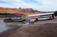
At Potash, the jet boat is loaded onto a trailer
and we are all bussed back to Moab and our cars. The boat is not
unloaded until it gets to town.
|