RETURN TO PREVIOUS INDEX
Gates of Lodore, June 21-25, 2010
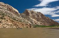
We ran the Gates of Lodore section Green River in Dinosaur National
Monument between June 21 and June 25, 2010 on a permit obtained by
Pete Whiteis. The crew was Pete, Jenn, and Phil Whiteis, Ron Thomas,
Janet Brook, Lamar, Jeremy, and Ben Baggett, Kathleen Hodgkinson,
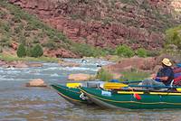
Cassie Parker, Pat Palmer, and Craig Walker. We had Ron and my
(Craig) big AIRE catarafts, Ron's Infinicat, Pete's new Jacks
Plastic Welding Culebra Grande and Kathleen's Tributary inflatable
kayak.
All photos were taken with my Pentax K10D and various lenses.
Postprocessing from the raw files was done in the Gimp. The
versions in this web show are relatively small size and have been
made with a fairly low jpg quality setting. Anyone wanting a
high quality version for printing or whatever should contact me.
I have them readily available - they just take too much space on
the web site.
As usual, I am thin on photos of us running the rapids. I am
both the photographer for this set, and the oarsman for one of the
boats. Since there are not very many boats in the group, we like
to take them all through together for mutual support. That means
I'm rowing, not shooting pictures, during these times.
DAY 1: JUNE 21 AND BEFORE
The first group of photos covers the drive to the river and the
first river day. The Socorro crew spent a night in Buena Vista and
had dinner at the Eddyline Brew Pub - the sister pub to the Socorro
Springs. We spent the night at a commercial campground just out of
town (Arrowhead Point Camping Resort). We spent the second night at
the putin at Gates of Lodore.
The river day included the first of the big rapids - Disaster
Falls. Camp was at Pot Creek.
RETURN TO PREVIOUS INDEX
Click on the image for a screen size version.
The "full size" version is larger (not available in web versions).
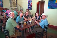
| Ron, Janet, Cassie, Kathleen, and Pat at the Eddyline Brew
Pub
|
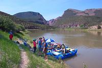
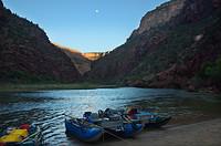
| The evening before launch. We assembled the boats
the day before our launch date. We were camped just inland
from the boats.
|
| Just about ready to shove off.
|
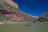
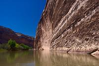
| In the Gates.
|
| Winnies Grotto. A scary thing happened. Rocks fell
down from above just as the Whiteis family was coming
into the Grotto - just below where Pat is here. We don't
know why they fell, but if some of the bigger ones had
hit someone, it would have been serious.
|
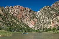
| The central part of Upper Disaster Falls. It looks easy here
but there are rocks upstream that force the boats more to the right
that you might like.
|
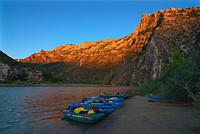
| The Pot Creek camp.
|
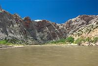
DAY 2: JUNE 22
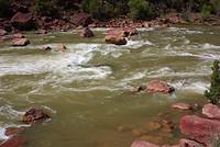
The major rapids of day 2 were Triplet Falls and Hell's Half Mile.
At Hell's Half Mile, we portaged the Culebra and IK around the top
bit. Pete just didn't feel familiar enough with the new boat to try
the class 4 rapid with a big rock (Lucifer) in the middle and a long
messy swim if there is a flip. The rest of us waited a while for the
water to go down, but gave up and ran. We all expected to run left of
the big rock, but the river had other ideas. We all ran right. Never
the less, we had good runs.
We stayed left in Triplet because of the nasty rock strainer
on the right at the very end. In fact, I strayed a bit too far
left and spent some time trying to get ungrounded.
Camp was at Wild Mountain.
RETURN TO PREVIOUS INDEX
Click on the image for a screen size version.
The "full size" version is larger (not available in web versions).
| Looking upstream from a small outcrop just above camp at Pot Creek.
|
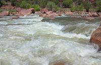
| Hells Half Mile. This was the last, and main, drop before Lucifer.
We planned to punch the hole in the foreground and go left, but the
river had other ideas and we ended up with clean runs on the tongue
further out, and then to the right of Lucifer. Even the ranger we talked
to at Jones Hole said the same thing happened to him.
|
| At the end of Hells Half Mile.
|
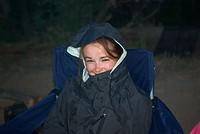
| Kathleen and Jenn after running all of Hells Half Mile below
Lucifer.
|
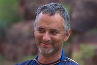
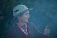
| Lamar - I tried a number of portraits with my new DFA 100mm Macro WR
lens. I like this lens!
|
| A shot of the Moon over the river. The contrast is huge and I
was only able to make this photo by combining two shots with different
exposures and by some selective work on the brightness of portions
of the photo.
|
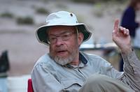
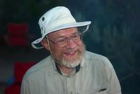
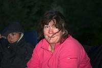
| Pat Palmer
|
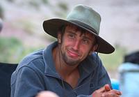
| Jeremy Baggett
|
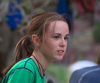
| Cassie Parker
|
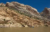
DAY 3: JUNE 23
This was the middle day of the Gates of Lodore trip and
the day we passed the confluence with the Yampa. At that point,
the river increased in size by a factor of several, going from
(according to the gauges) about 1800 cfs (daily range 850 to 2200)
to 8500 cfs (downstream a ways). The area around the confluence
is quite scenic and there are some petroglyphs. Echo Park is a
river access point and a place we could get water from a faucet.
But it was mosquito infested. Unfortunately there was very little
wind so the bugs stayed with the boats for quite a while.
Camp was at Jones Hole, which is a nice, reasonably high volume
creek with fish. After camp was set up, I went to take a dip in the
river and returned after a few minutes to fine everyone gone. They
had started on hike and had forgotten about me. I guessed they
had gone to the creek, so I started out with camera and sandals with
no socks. I wound up hiking about 4 miles that way and nearly
caught them, but didn't know where they were after a junction.
The Baggetts caught 3 fish. In the morning they got more and that
was the dinner the following night.
RETURN TO PREVIOUS INDEX
Click on the image for a screen size version.
The "full size" version is larger (not available in web versions).
|
|
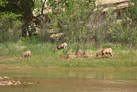
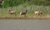
| We saw a number of rocky mountain sheep during the trip.
|
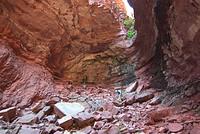
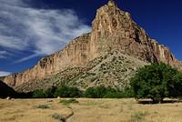
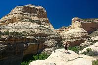
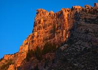
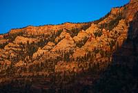
| There was losts of interesting geology hitting you in the face
on this trip.
|
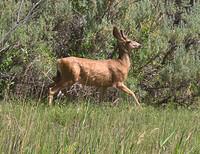
| A deer.
|
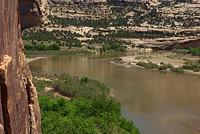
| Approaching Echo Park and the confluence with the Yampa River.
|
|
|
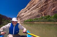
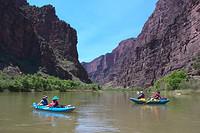
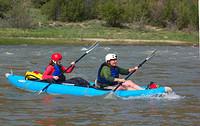
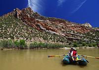
| Pat rowing near Echo Park.
|
|
|
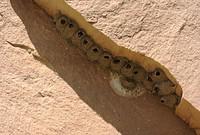
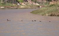
| There were lots of what I presume were cliff swallows in the area.
Note that most of these nests have a bird peering out.
|
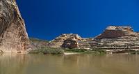
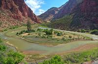
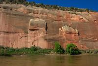
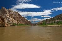
| The confluence. The Green River is on the left against the cliffs.
The Yampa is on the right. The Green has a large dam (Flaming Gorge)
upstream and has a carefully controlled flow. The Yampa is free flowing.
During the spring runoff season, which was starting to taper down when
we were there, but was still fairly high, the Yampa is much the larger
river.
|
| Echo Park on the far side of the river can be reached by
car.
|
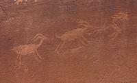
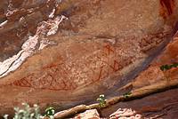
| Some of the petroglyphs on the cliffs on the west side of the
river at Echo Park.
|
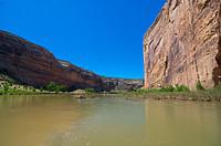
| Looking back at the confluence from the petroglyphs.
|
| Some more geology downstream from Echo Park.
|
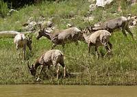
| Another group of sheep. They insisted on pointing their bums my
way so I didn't get the best of pictures.
|
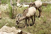
| Another of the sheep. The lens is my Pentax F 80-200 lens left
over from the film days.
|
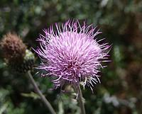
| Someone want to help me with the flower name?
|
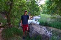
| From behind camp at Jones hole at the start of the walk up the
creek.
|
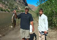
| Ben with the first fish from Jones Hole Creek
|
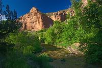
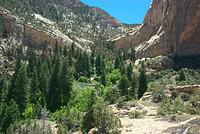
| Jones Hole Creek. It comes from a spring at a fish hatchery
about 4 miles upstream from the river.
|
DAY 4: JUNE 24
June 24 mostly spent hiking and fishing at Jones Hole. We
actually moved our boats to the Day Use boat beach because we would
have collided with the next incoming party. We hiked up the creek to
see the petroglyphs and a waterfall. The waterfall could be dammed by
people sitting in the creek above. One could get a good shower by
getting under it while it was dammed and then having the people
sitting in it stand up. There are photos showing this sequence.
Eventually we moved down to Cove camp. It was nice except
for the Arctic grade mosquitos. I've learned to live with such
things, but most of the group was going nuts. There was some
nice lighting in the evening. The Baggetts had caught several
more fish in the morning, so we had a good feed of trout this
evening.
RETURN TO PREVIOUS INDEX
Click on the image for a screen size version.
The "full size" version is larger (not available in web versions).
| The morning's take by the Baggett family. This is our dinner
for the next night.
|
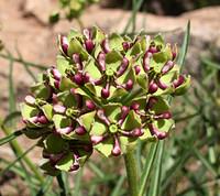
| Again, can someone help with the flower name?
|
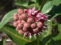
| And yet gain, can someone help with the flower name?
|
| One of the pictographs just beyond the Ely Creek trail junction
in Jones Hole Canyon.
|
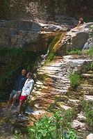
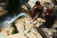
| The small falls along Ely Creek that can be butt dammed to make
a good shower. This is the state while the dams are in place (note
Cassie sitting in the creek) and the flow stopped.
|
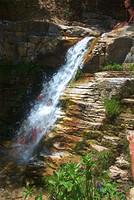
| Here the dams are let go (see Cassie sitting up) and Lamar and
Jeremy are getting a good dousing.
|
| Phil and Cassie (and maybe others upstream) have just let
the flod down on someone.
|
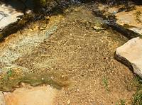
| A closeup of the creek above the falls.
|
| Cassie and the view from a small summit that we walked to above
the falls.
|
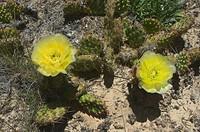
| Prickly Pear flowers.
|
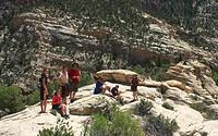
| The group in the small summit - or really a ridge.
|
| Looking across Ely Creek. The trail to Island Park goes up there
somewhere.
|
| Some bighorn sheep that were across from the Cove campsite.
|
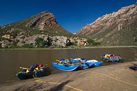
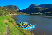
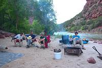
| The boats at the Cove campsite.
|
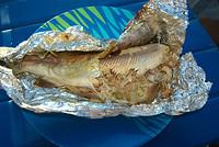
| One of the fish, partially eaten.
|
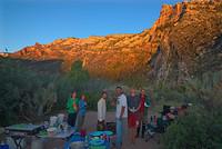
| The Cove camp near sunset.
|
| The boats at sunset.
|
| The ridge above camp.
|
| Farther along the ridge in the sunset light.
|
| Pat.
|
| Janet, using smoke to deal with the mosquitos.
|
| Cassie hiding from the mosquitos. It certainly was
not raining.
|
| Jenn says too many mosquitos!
|

| Another of Pat.
|
DAY 5: JUNE 25
June 25 was the last day of the Gates of Lodore trip. We
continued down through Rinbow Park and Split Mountain Canyon. In
Split Mountain Canyon, there were rapids with moderately big waves
including one vertical one that slammed the box on the front of my
raft and nearly stopped us.
Eventually we got to the takeout were we derigged. There
was a groover dump station that I used to empty the cans. We
drove to Glenwood Springs and stayed at the Cedar Motel. We
had quite a nice dinner at the Rivers Restaurant (I think the
name is right). The following day, Ron and Janet went to see
other family over toward Buena Vista while Jenn and Cassie in
Jenn's car and Kathleen, Pat, and I in the Suburban drove back
to Socorro. Jenn came to Socorro because Pip will be getting
married soon.
RETURN TO PREVIOUS INDEX
Click on the image for a screen size version.
The "full size" version is larger (not available in web versions).
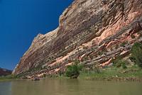
| The wall that was reputed to have a pectoglyph of a large buffalo.
We kept watching for it.
|
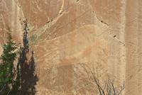
| Finally I spotted the buffalo
petroglyph after we had almost gone by. I fired off a couple of
pictures. This picture actually shows it better than I saw it because
of the rush at the time.
|
| Heading into Split Mountain Canyon.
|
| More Split Mountain Canyon.
|
| And more.
|
| Nearing the takeout, which is just out of site down
the river in this photo.
|