Navigation: Index page
Middle Fork of the Salmon 2013
We finally won the lottery for a permit for the Middle Fork of the
Salmon after years of trying. We were on the river from July 20-27.
The water was rather low, between 1.96 to 1.83 on the Middle Fork
Lodge gauge. We took mostly small boats - a canoe, two Infinicats,
12' and 14' self-bailers and my 16' cat - and tried to keep the loads
light. The crew was Janet (permit holder), Ron, Kerry, Sharon, Mary,
Sally, Phil, Dave, Tina, and myself (Craig).
The low water was a bit painful and everyone got hung occasionally
(ok, maybe not the canoe). But we got through ok. It is not clear
that small boats are better, at least among rafts. The big sweep
boats used by the commercial outfits for gear seemed to get through,
although we did help push one or two off shallow spots. I think they
just ran soft and slithered over the rocks. If I do it again at low
water, I would be tempted to take my canoe. I did get to paddle
Phil's for a morning, which was fun.
We had one significant incident on the river. Ron and Janet
wrapped their Infinicat on a rock a few miles before Pistol Creek. We
had to use ropes to get Ron and Janet to shore, then unload the boat,
and use a Z drag to pull it off. We had help from a commercial group,
especially one guide. That guide and Dave were the ones who unloaded
the boat and secured the boat end of the Z drag. I think we could
have handled it ourselves, but it would have taken longer.
There were some serious fires in Idaho while we were on the river.
The Papoose Fire came right to the river's edge in the lower parts.
We were not signed up for affected campsites so we did not need any
change of plans. Others did. There was a tree down about 2/3 of the
way across the river at one point that was felled by the fire. It was
a bit tricky for the bigger boats as there was a rock blocking the
safest, far-right approach. But we all got by ok. Tragically, later
that day, an Idaho woman on a commercial trip, paddling an IK, did not
avoid it and was drowned. I gather some river guides pulled the tree
off the river later.
I took most of my photos my new 18-135mm Pentax lens. That is a
very useful focal range and it is water resistent, as is the camera.
It is not quite the quality of my Pentax Limited primes or the
12-24mm, but it gets the job done. Some reviews and early samples
show it to be very soft near the edges, but I find it is ok as long as
you do chromatic aberration corrections, which the camera can do for
the jpgs or a photo tool can do in postprocessing. With the large
focal length range, I don't have to change lenses often which is
useful when rowing alone on the boat. The camera was my Pentax K5. I
found it hard to get photos at the rapids because I was rowing and we
wanted to keep the boats near each other.
Navigation: Index page
Click on the image for a screen size version.
The "2000" and "full size" versions are larger (not available in web versions).
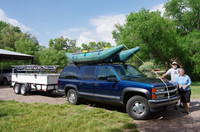
Ready to leave from Ron and Janet's place.
|
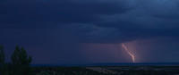
Lightning at Monticello, Utah
|
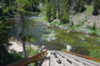
The launch ramp at Boundary Creek. The boats are lowered
using a rope and guided by people walking along side.
|
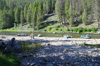
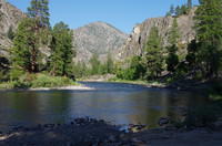
Looking upstream past the launch ramp. The boat is from
another party.
|
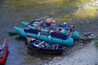
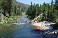
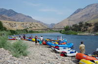
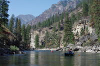
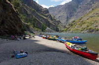
These sweep boats are how many of the commercial groups
carry their gear. And we thought we needed small boats!
|
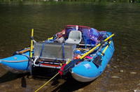
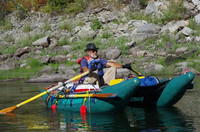
My AIRE Jaguarundi ready to go. I was rowing alone. It is
more convient with a passenger who can row occasionally, especially
when you want to take pictures! I did have gear for more than
just me.
|
Sally on her Infinicat at Sulfer Slide.
|
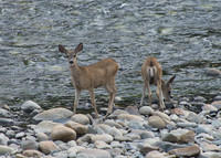
Deer at our Trail Flat campsite.
|
At Trail Flat. The pool in the foreground is part of the
hot spring complex there and made for some pleasant soaking.
We camped in the flat area in the woods well above the river.
|
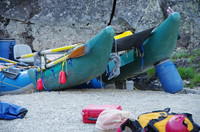
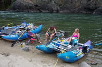
During the second day, Ron and Janet wrapped their
Infinicat on a rock. We pulled them off and the
boat, remarkably, survived. But there was a small crack and it
took on some water. Here we are trying to drain it back out through
the crack (the tubes are otherwise airtight).
|
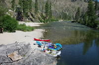
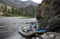
The Pistol Creek campsite with the creek entering the Middle Fork just
beyond. Unfortunately, I don't have photos of the rapid.
|
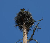
A tree top nest and resident osprey.
|
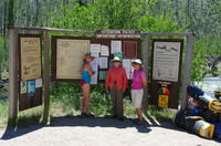
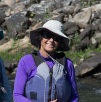
Sally, Sharon, and Mary at Indian Creek. A sign at the ranger station
said the river was at 1.89 ft, which is rather low.
|
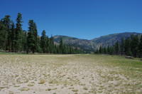
The runway at Indian Creek. At these water levels, many groups launch,
or at least pick up their passengers, here. This trip never did give
me the sense of deep wilderness that I have had on my northern trips.
There were cabins and other evidence of civilization fairly often.
|
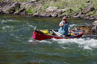
Phil peeling out below one of the rapids.
|
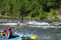
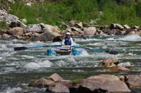
Sally and Mary in one of the rapids where you have to make a sharp
right turn. The waves were small at this water level, but finding a
path through was not always easy.
|
Mary on Sally's boat.
|
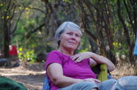
Janet at Upper Jackass camp.
|
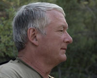
Kerry at Upper Jackass camp.
|
Ron and Janet at Upper Jackass camp.
|
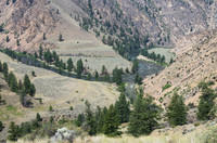
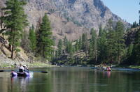
View downstream from Upper Jackass camp, giving
some sense of the nature of the country.
|
View upstream from Upper Jackass camp over the landing
area.
|
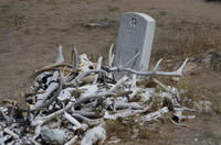
The grave of Whitie Cox.
|
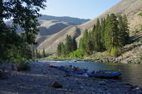
Two sweep boats passing our lunch spot at Whitie Cox Camp.
Another was unloading at the camp.
|
Along the river somewhere before our Camas Creek camp.
|
At the Camas Creek campsite. We are starting to be rather
affected by the smoke from the Papoose Fire. We spent two
nights here.
|
The Camas Creek camp at the intersection of Camas Creek
and the Middle Fork as seen from a trail on which a few
of us took a hike.
|
Looking up Camas Creek from the trail.
|
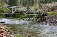
The bridge over Camas Creek that serves both the trail we took
and the one up the creek.
|
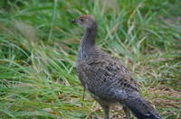
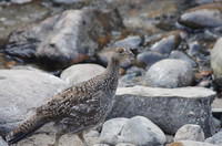
A grouse during the layover day.
|
The same bird.
|
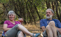
Tina and Dave at Camas Creek.
|
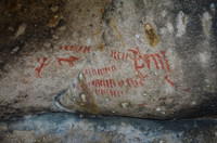
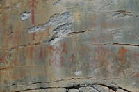
Some pictographs at Shark Fin Rock. There were a lot
of other people there.
|
The landing area at the Flying B ranch. We got information from
the rangers about the fire area ahead and bought some ice cream and
sodas.
|
The Flying B ranch. Definitely not deep wilderness.
|
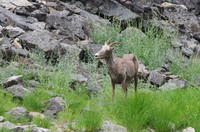
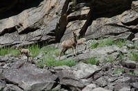
A big horn sheep along the river. We saw only females and young.
|
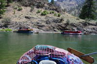
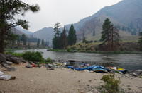
At the lunch stop.
|
At Fly Camp. It's pretty warm and the water feels good.
|
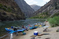
The landing area and kitchen at Fly Camp.
|
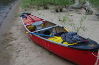
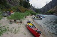
Phil's canoe.
|
Fly Camp.
|
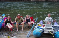
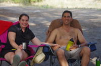
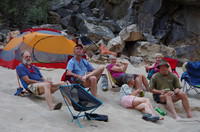
Tina, Kerry, Sharon, and Phil enjoying the river at Fly Camp.
|
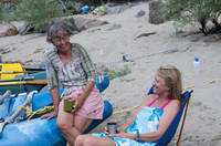
The sisters Mary and Sally.
|
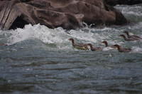
A family of mergansers working their way upstream.
|
Ron on his somewhat damaged Infinicat. As the river got a bit
larger, he took more gear.
|
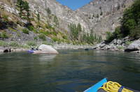
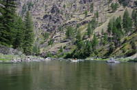
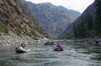
Along the river in a quiet stretch.
|
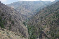
In the area of the Papoose Fire. The hillside stright ahead
has been burned and you can see a bit of smoke still coming
up about upper center in the picture.
|
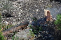
Some clear fire damage. The fire probably was not all that
intense here as the bigger trees mostly seem to have survived.
|
Looking back on some of the fire affected region. Again the
ground is charred but the trees mostly look ok. This may not
have been representative of the whole fire.
|
Some more big horn sheep.
|
Some of the "Tombstone Pictographs".
|
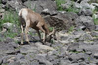
A big horn sheep eating.
|
A lunch stop, our last on the river since we finished the following
morning.
|
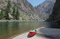
The canyon and Phil's canoe at the lunch stop.
|
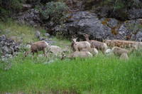
A group of big horn sheep along the river.
|
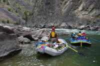
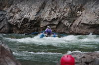
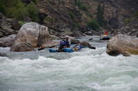
Waiting for the last boats at Lower Cliffside Rapid.
Sally and Mary can just be seen in the upper part of the rapid.
|
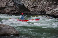
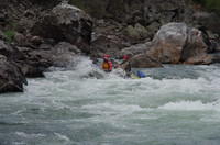
Sally and Mary in Lower Cliffside Rapid
|

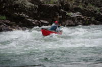
Phil bracing in Lower Cliffside Rapid.
|
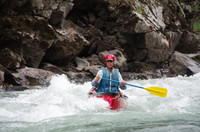
Phil in Lower Cliffside Rapid.
|
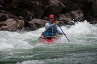
Phil in another rapid.
|
Made it! (this is about the end of the rapid).
|
Another of Phil near the end of the rapid. Somewhat of
a different character picture from the last. More clarity
here, but more sense of motion in the other.
|
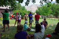
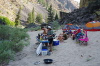
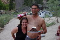
Dave and Tina were cooking the last evening at Solitude Camp.
Here the rest are waiting. Left to right, they are Ron, Phil, Janet,
Mary, Sharon, and Kerry.
|
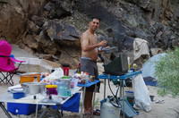
Dave working on dinner.
|
Dinner being prepared.
|
Tina and Dave playing around.
|
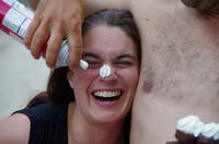
This is starting to deteriorate.
|
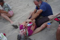
Then it spread - Ron and Janet going at it.
|
I almost got a new passenger on the last day.
|
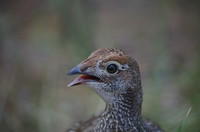
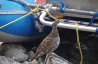
Another of one of our visitors. There were several
in a group. These are Franklin's grouse.
|
Sally and Mary approaching one of the rapids on the final day
with Kerry and Sharon behind.
|
Kerry and Sharon bouncing a bit. But at this water level,
the main issue was rock avoidance, not big waves.
|
Approaching the confluence with the Main Salmon River. Our
cars were at the takeout at the confluence, not a the more typical
place a few miles downstream. I was too busy at the takeout to take
photos so I don't have pictures there.
|