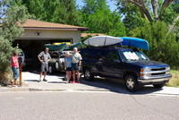
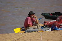
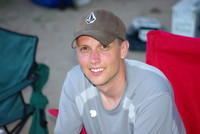
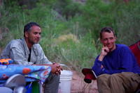
| About to leave home with Mary, Sam, Sharon, Kerry (in photo) and myself
in the Suburban with 6 boats and a lot of gear.
|
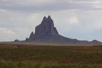
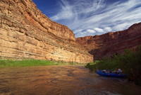
| Shiprock, on the way to the launch point near Bluff.
|
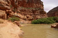
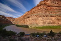
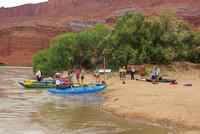
| At the Sand Island campground. The boatramp is near the more distant
trees.
|
| My 16' cat ready to go.
|
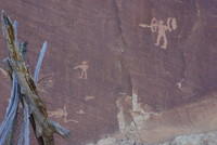
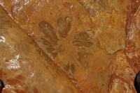
| Some petroglyphs near the Butler Wash camp. Clearly these are not
ancient as they seem to show soldiers with guns. Others in the area
were likely much older.
|
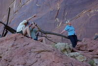
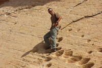
| Looking at petroglyphs near the Butler Wash camp.
|
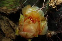
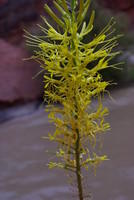
| A cactus flower near the petroglyphs.
|
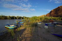
| The Butler Wash campsite.
|
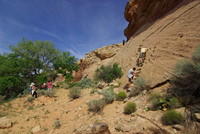
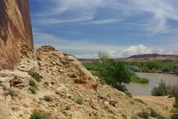
| The next morning we walked upriver along the cliffs to an old
village site. There were large steps in the rock face.
|
| Lamar on the steps.
|
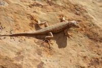
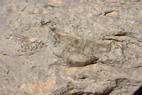
| One of the local lizards.
|
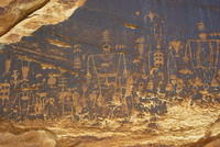
| The main Butler Wash petroglyphs were a bit downstream (no
camping there). We
stopped there shortly after launching for the day. This is one
of the more impressive panels.
|
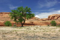
| The view from near the petroglyphs.
|
| We visited Big House ruin. We stopped a bit too far upstream
and had a bit of a walk, although this part was scenic.
|
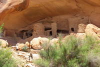
| Big House ruin. Not the large snake pictograph above the
buildings.
|
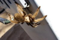
| We had a hitchhiker today - a large spider in the big
duffel bag that held the folding chairs and table. It's
about 3" across. I don't think it is a tarantula, but I'm
not sure what it is.
|
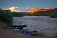
| Ron on his boat at camp.
|
| This day we stayed at "Big Stick" campsite. You can just see
the big stick near the water with a kayak paddle and PFD on it. This
was an outstanding campsite.
|
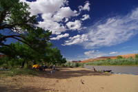
| Looking upriver from the campsite with my wide angle lens and
a polarizer.
|
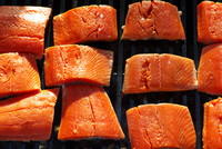
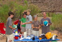
| Salmon for dinner!
|
| Sam Hankins in camp.
|
| An evening shot up the river from Big Stick campsite.
|
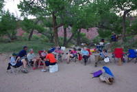
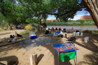
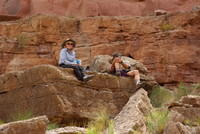
| Sitting around camp.
|
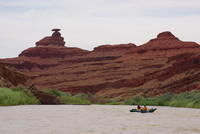
| The Mexican Hat after which the town is named. The Whiteis's
joined us at the BLM boat launch ramp. We were able to refresh
our ice and water.
|
| With lots of ice, what better than ice cream for desert that
night at Tabernacle Camp. We had two of the soccer ball type
ice cream makers and everyone took turns shaking them.
|
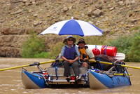
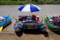
| Kerry and Sharon on my raft. Note that the umbrella was nice
while the wind was light, but that was not that large a fraction
of the trip.
|
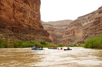
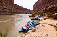
| Six of our 8 boats.
|
| At the top of Honaker trail. We got to camp early. The plan
was to do the hike the next day, but we had lots of time left and
it was cloudy and cool, so we did it in the afternoon.
|
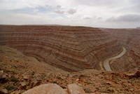
| A wide angle view of the canyon and river from the top of the
Honaker trail.
|
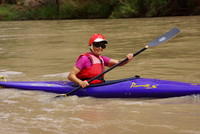
| Mary in her kayak.
|
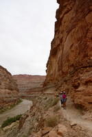
| Mary, Jenn (nearly hidden behind Mary), and Sharon on the
trail to the pool in John's Canyon. This trail had a couple
of "interesting" climbing spots.
|
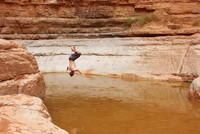
| Sam doing a flip into the pool.
|
| Back at the river. Camp is in the bushes. This was a
bay at the mouth (waterfall) of John's Canyon.
|
| One of the flowers in the foreground of the last picture.
|
| Pete playing with Sam's kayak. While we were running, he
was in the NMT self bailer.
|
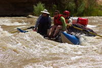
| The next several photos are of various runs through Government
Rapid, the biggest of the trip. It's pretty small by Grand Canyon
standards. There were very high winds which was giving me trouble
with the canoe so I took a sneak route. This is Ron and Janet in
the Infinicat. Unfortunately the focus is on the canyon wall, not
the boat, but the picture is more dramatic than others that were
focused on the boat.
|
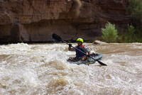
| Mary on her run.
|
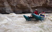
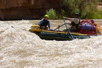
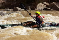
| Phil got to row the self bailer through the rapid with Pete
in the bow.
|
| Lamar and Ben in Ron's big cat. Note bend on that oar!
|
| Sam early in his run. There really is a boat there, I promise.
|
| Sam, later.
|
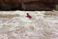
| Sam about to go into a largish wave.
|
| Sam coming out of the wave. Again, the focus was not really in
the optimal place - it is on the front of the boat, not on Sam.
|
| Sam making it look exciting.
|
| Another of Sam. He gave me the best photo-ops. It looks like he
might be about to turn over, but he didn't.
|
| Sam lower in the rapid.
|
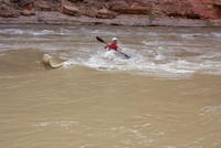
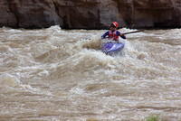
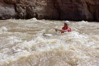
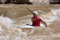
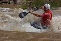
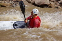
| Jeremy running the sit-on-top sea kayak through Government Rapid.
He did well.
|
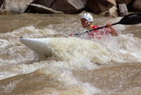
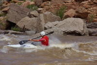
| Jeremy in the middle of the rapid.
|
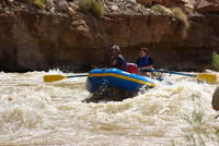
| Kerry bringing Sharon and Jenn through on my cataraft.
|
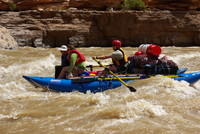
| Another of Kerry and company. The waves weren't big enough to
make the big cats do much besides just plow straight through.
|
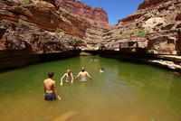
| Camp this night is a Slickhorn B. We walked up the canyon to
this pool and had a swim. A few went further up the canyon to
another pool that was somewhat larger, but not quite as inviting.
|
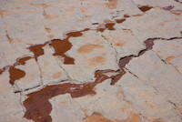
| Some rock details.
|
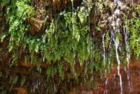
| The waterfall at the head of the upper pool.
|
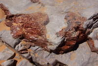
| There were a lot of fossils in the area.
|
| Another rock closeup.
|
| Some more fossils. I should get Jenn to help me label the photos.
|
| More fossils, wetted to help them show better.
|
| The tiny stream working it's way across one of the flat sections
of the canyon floor.
|
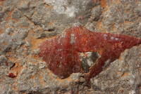
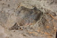
| More fossils - shells this time.
|
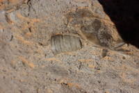
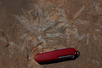
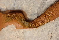
| The stem of a fossil plant - the same type as the one above by
the knife according to Jenn.
|
| A particularily nice shell. It was nice to have the macro lens
along.
|
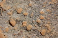
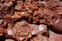
| More shell fossils, showing how dense they were in this layer.
|
| A closeup of the stream.
|
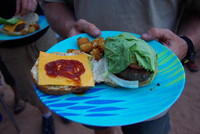
| Dinner - Buffalo burgers.
|
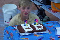
| It was Ben's birthday and we had a party.
|
| Jenn.
|
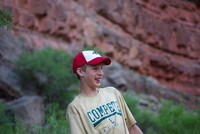
| Ben.
|
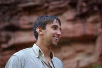
| Jeremy. If he looks a bit wet (ie soaked), it is because of
a water fight triggered when Janet gave Ben a sqirt gun, then passed
out loaded squirt guns to everyone else. Eventually Jeremy threw
Ben in the river and there was a lot of splashing just before this
photo was taken. I have photos, but all are a bit blurry or have other
problems. I was somewhat hampered by needing to protect the camera.
|
| Lamar and Sam watching the festivities. Note they are a bit wet
from the water fight.
|
| Then Janet got out these gizmos that let you support a ball in
the air by blowing into it.
|
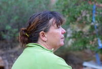
| The instigator - Janet Brook.
|
| The next morning at camp looking down on Slickhorn Rapid.
That rapid was basically washed out at this water level. In 1993,
we remember fairly big waves - the water may have been higher.
|
| The Slickhorn B campsite in the morning.
|
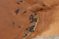
| We went back for another swim in the morning. These guppies were
in one of the pools in the canyon.
|
| Sharon and Kerry stayed in camp and waited for us - Kerry asleep.
|
| At the mouth of Grand Gulch.
|
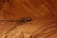
| A lizard in Grand Gulch. He looks pretty mad at me!
|
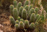
| A cactus in Grand Gulch.
|
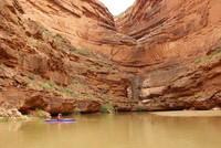
| A side canyon with the river backed up into it enough to paddle in.
Mary checking it out. Only Mary and I went in.
|
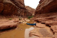
| Steer Gulch. I'm the only one who went all the way into the canyon.
We had reserved the campsite near the mouth of the canyon. But it proved
to be mosquito infested so we decided to go on to the takeout. Sam
came and got me from the canyon as the others went on.
|
| Clay Hills takeout. The sign that is down warns of a waterfall a mile
or two downstream (Fatt falls). Those falls are a result of the silting and
subsequent drop of Lake Powell causing a rerouting of the river.
|
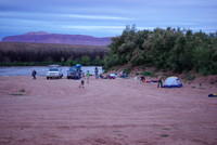
| The cars were there, but it was late so we camped at the takeout. It
was actually a fairly nice campsite. There was a latrine nearby, but no
other facilities except roads and parking areas. This is us getting ready
to leave early in the morning.
|
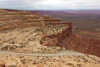
| The road to Mexican Hat from the north makes this rather impressive
drop. Note that, while the part of the road in the picture is dirt,
it is a good paved, 65 mph road on the flats. I suspect that they left
it dirt on the hill to avoid ice problems in winter, but I don't know for
sure.
|