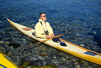
 Sea Kayaking near
Nuuk, Greenland. Sea Kayaking near
Nuuk, Greenland.
Sea Kayaking near
Nuuk, Greenland. Sea Kayaking near
Nuuk, Greenland. The photos presented here were taken by me (Craig Walker) during the "Greenland Getaway" trip run by the Wilderness Adventure Company, otherwise known as Black Feather. We were in Greenland from July 31 to Aug 14, 2001. The first and last nights were spent in Nuuk. The rest were in camps beside the fjords to the northeast of Nuuk. In the picture descriptions, a day number is both the day since we started paddling and the date in August since we started on Aug 1.
The flag above is the flag of Greenland. Greenland is a part of the
Kingdom of Denmark, but has home rule. Nuuk is the capital and has a
population of about 15000, making it comparable to Yellowknife or
Whitehorse in the Canadian north.
This web version of the "slide show" gives a few selected pictures.
I have made a much more extensive version which I can put on a CD for
participants and friends.
RETURN TO PREVIOUS INDEX
In the index below, click on the small image for a version
that is 1000 pixels in the longest dimension. Larger versions
are available on the CD.
|
Click on the image for a screen size version. |
|
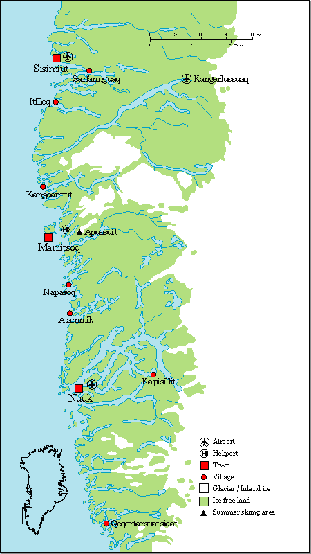 |
Map of southwestern Greenland. We flew first to Kangerlussuaq, where there is a large airport that can handle international flights. It was once a US air base. From there we flew to Nuuk, were we kayaked in the fjords to the northeast of town. The flight from to Kangerlussuaq was from Ottawa via Iqaluit, capital of Nunavut. This map was found on the web. |
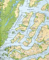 |
This is a scan of a portion of a Saga map showing the region of the trip. I have marked the route and numbered the camps. |
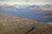 |
A view from the air of the fjord region where we were kayaking. I believe that this is a view through the gap between the Sadelø and Bjørneøen islands. If so, our Day 9 camp was in the little bay on the near shore on the left. |
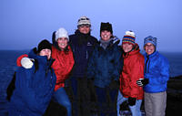 |
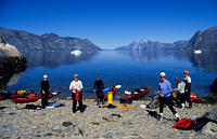
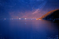
Lisa, Megan, Andrea, Martha, Susie, and Stacey in a group shot taken during our attempt to see whales late on the evening of the first day in Nuuk. No whales. This was about as cold as it got on the trip. |
 |
Lunch on the third day. |
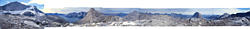 |
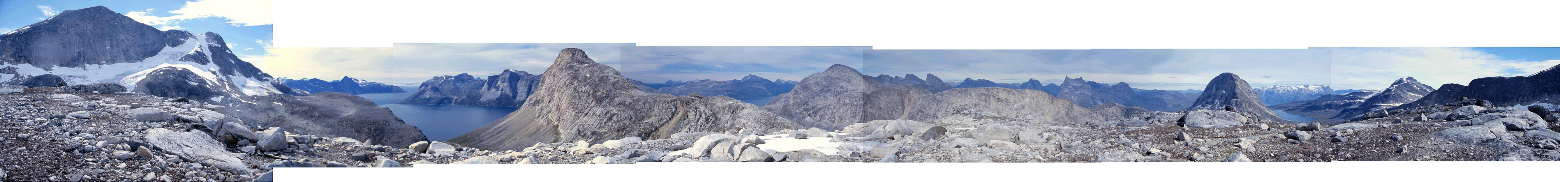
This is a panoramic view covering very close to 360 degrees taken from the top of the side peak to Qupik that was reached by Lisa and I on the Day 4 hike. It is a combination of 7 separate, wide angle photos, most taken in my camera's panorama mode. The photos were combined after scanning. The photos don't match perfectly at the boundaries, but are pretty close. For a perfect match, I would need to be careful to take all of the photos from exactly the same spot and would need to use special software to correct distortions due to the lens. Here is a Larger version |
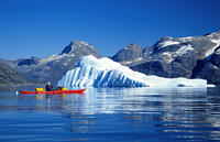 |
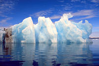
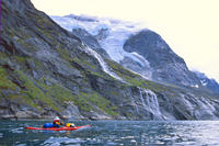
Lisa and an iceberg early in the trip. |
 |
Lunch on day 5. Megan and Martha are getting stuff from the boats. |
 |
Evening shot across the fjord from the camp used on days 6 and 7. |
 |
This is an iceberg that has rolled. The well defined laryer of dirt is interesting. That layer was probably on the surface, or bottom, when passing near rock, although I suppose that it might have been the surface when there was a lot of atmospheric dust or ash. |
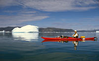 |
Jay and iceberg. |
 |
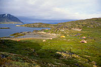
Panorama photo looking over the Godthåbsfjord from the hill next to Qormoq. |
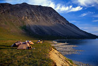 |
Day 8 camp near sunset. |
 |
The Day 9 campsite at Qingaussâ. There are ancient Inuit ruins both in the foreground/left and on the peninsula in the distance, but still on this island. The big one is Qarusuk, on the peninsula. There is also a much more modern cabin just beyond camp. It may have been from a geological survey of some sort. |
 |
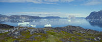
This shot was taken while paddling along the west shore of Sadelø. The mountain shown here is Sadlen. |
 |
Sunset from near camp on Sadelø looking across the Godthåbsfjord. |
 |
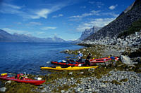
After we arrived at the Day 11 campsite, which is near Nuuk, 3 local kayakers showed up. The other two were in modern plastic boats, but this man had a traditional hand-made Greenland style kayak that he had recently built. In fact it wasn't quite done as can be seen by the duct tape over the unfinished front hatch. |
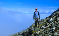 |
During day 12, Lisa, Stacey and I started hiking in wet foggy weather. We followed a stream up on the assumption that we could follow it back down. It was too cloudy for any other type of navigation and I had left my compass and gps in camp! As we got high, we suddenly broke out of the clouds. This was an unexpected and magical moment. Here is stacey just after we broke out |
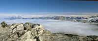 |
A panorama mode shot from the top looking northeast. Here you can see the clouds we had been in for most of the climb. |
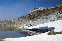 |
The view back toward the mountain from one of the small lakes we passed on the way down. |
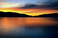 |
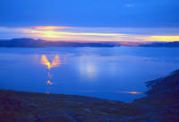
A sunset to end the show. This was from the Day 8 camp near the village of Qormoq. |
Technical details:
Film - first roll
(Ottawa and Nuuk): Kodak Elite Chrome 100
Film for most of
trip: Fuji Velvia slide film.
Camera: Pentax
ZX-5.
Lenses: Pentax
28-70mm zoom, 50mm f1.7, and 80-200mm zoom.
Filter: If there
is any blue in the sky, a polarizing filter was probably used.
Scanner:
Minolta Dimage Scan Elite film scanner
Scanning software:
Vuescan under Linux
Scanning resolution:
Mostly 1410 dpi. Blowups at 2820 dpi.
Automatic resizing
and sharpening done with Convert.
A few images were processed
with xv or the Gimp.